News Category: Research

Understanding Glacial Lake Hazards Made Easier with GLOFCA Project

In a bid to comprehend the potential dangers of glacial lakes, the Glacial Lake Outburst Floods in Central Asia (GLOFCA) project has emerged as a significant contributor to regional best practices. By leveraging cutting-edge technologies and international expertise, the project aims to create a safer future for Central Asian communities.

Mapping Glacial Lakes – A Crucial First Step

One of GLOFCA’s main contributions lies in creating a comprehensive and up-to-date inventory of glacial lakes across the region. This step is crucial as it allows experts to monitor changes over time and identify lakes that may pose potential hazards. Central Asia’s unique terrain has shown that new lakes can form rapidly, making regular mapping essential, even during adverse weather conditions or cloud cover.

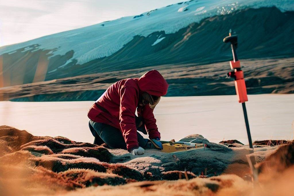
To achieve this, the project is developing the Glacial Lakes Inventory (GLI) toolbox, utilizing the python Tkinter library. This toolbox will monitor lake dynamics and provide statistics on surface area changes, the appearance of new lakes, and the disappearance of existing ones. The toolbox relies on Sentinel-2 Normalised Difference Water Index (NDWI) to detect glacial lakes, and an exciting deep learning-based methodology that fuses information from Sentinel-1 Synthetic Aperture Radar (SAR) and Sentinel-2 optical satellite data, allowing high-resolution monitoring year-round.

Overcoming Challenges

Mapping and monitoring glacial lakes using satellite sensors come with challenges. Many of these lakes are small and frozen for a significant part of the year, making detection difficult. Furthermore, clouds, cast shadows, lake turbidity, and atmospheric conditions pose additional hurdles. However, the GLOFCA project’s state-of-the-art algorithms and techniques show promising results, even detecting lakes as small as 0.01 km² in area.

The Role of Deep Learning

The GLOFCA project employs an advanced deep learning algorithm called the Glacial Lakes Monitoring (GLM) network. This network uses a combination of satellite data from both Sentinel-1 SAR and Sentinel-2 sensors to create a comprehensive and data-driven approach to glacial lake monitoring. The deep learning process involves semantic segmentation, classifying each pixel as either lake or background, ultimately providing experts with valuable data on glacial lake extents.

Advancing Susceptibility Assessment

The GLOFCA project not only focuses on lake mapping but also advances susceptibility assessment. By combining regional expertise and international best practices, the project presents a comprehensive checklist for experts to evaluate factors that contribute to GLOF susceptibility. This guidance aids in prioritizing glacial lakes for further monitoring and action.

A Safer Future for Central Asia

As GLOFCA continues its mission, Central Asian communities can rest assured that innovative technologies and international collaborations are making great strides in understanding glacial lake hazards. By harnessing the power of satellite data and deep learning, the project is laying the groundwork for safer, more resilient communities in the face of potential glacial lake outburst floods.

Conclusion

For detailed information, please refer to Chapter 4 GLOFCA contribution to regional best practices of the comprehensive document titled: Glacial Lakes Outburst Flood: Best Practice Guidance

Protecting Communities from Glacial Lake Hazards: Central Asian Approaches and Practical Applications

Glacial lakes, though stunning, can hold hidden dangers for nearby communities. A recent scientific paper explores how Central Asian countries assess these hazards to safeguard their people. By understanding the factors that make some lakes more susceptible to catastrophic outbursts, authorities can take practical steps to protect communities.

A Journey Through Central Asian Approaches

In Central Asia, experts refer to “lake hazard assessment,” which is similar to “lake susceptibility assessment.” This first step involves selecting lakes for detailed evaluation. For instance, Uzbekistan assesses lakes above 1500 m a.s.l. that drain into the country. Kazakhstan, since 2015, examines all moraine lakes, while Kyrgyzstan focuses on lakes prone to Glacial Lake Outburst Floods (GLOFs), listed in a national lake atlas. Tajikistan conducts hazard assessments in three stages: preliminary analysis, identifying possible hazards, and analyzing consequences.

Categorizing Lakes for Safety

Central Asian countries categorize lakes based on various characteristics influenced by atmospheric, geological, and hydrological processes. Lakes fall into 2 hazard categories in Kazakhstan, 3 in Uzbekistan and Tajikistan, and 4 in Kyrgyzstan. Expert judgment and field observations, like bathymetry and aerial photographs, guide the categorization process. Parameters like lake type, dam composition, and glacier proximity are considered.

The Hidden Threat of Non-Stationary Lakes

Although non-stationary lakes are fewer, they account for over 50% of catastrophic GLOFs. These dynamic lakes fill up quickly during the ablation period, leading to potential outbursts. The blockage of ice tunnels and subsequent opening of underground runoff channels often cause these outbursts. Lakes aged 20 or more years pose minimal threats, but monitoring remains vital.

The Role of Remote Sensing

Advanced remote sensing methods, such as space imagery and daily synoptic forecasts, play a crucial role in monitoring lake changes in size and volume. Special attention is given to non-stationary lakes, ensuring timely action if needed. Regular reassessment of lake inventories and hazard potential further enhances community safety.

Conclusion

Central Asian countries take lake hazard assessment seriously to protect communities from glacial lake outbursts. By understanding the factors contributing to lake hazards and employing remote sensing technologies, authorities can stay vigilant. With ongoing monitoring and reassessment, they ensure timely preventive measures and secure the safety of those living near these awe-inspiring natural wonders.

Reference

For detailed information, please refer to Chapter 3.2 National approaches used for susceptibility assessment of the comprehensive document titled: Glacial Lakes Outburst Flood: Best Practice Guidance

Understanding Glacial Lake Outburst Floods: Key Determinants and Future Threats

Glacial lakes are not just serene bodies of water; they can pose a significant threat to nearby areas. A recent scientific paper sheds light on the key factors that determine the susceptibility and magnitude of glacial lake outburst floods (GLOFs). Understanding these determinants is crucial for predicting future threats and implementing effective measures to protect vulnerable communities.

Key Determinants

According to the study, the size of the glacier lake, the outburst mechanism, and the characteristics of the downstream torrent are the main determinants of GLOF susceptibility and event magnitude. Large lakes have the potential for greater flood magnitudes, but they are also more susceptible to impacts from rock and ice. However, solely focusing on absolute lake size can be misleading, as dangerous situations involving smaller or rapidly changing lakes may be overlooked.

Measuring Lake Volumes

Direct measurements of lake volumes in remote regions have been challenging and rare. To overcome this, researchers have found innovative solutions. The study highlights the use of small unmanned boats equipped with sonar instruments as a safe and cost-effective option for surveying critical lakes and obtaining detailed bathymetries. Additionally, empirical equations linking mean lake depths with lake area provide a first-order estimate of lake volume for regional to basin-scale studies.

Anticipating Future Threats

The research emphasizes the importance of anticipating future threats related to glacial lake expansion and development. By considering the geomorphological context and utilizing morphological criteria or modelled bed topography, possible locations where lakes may develop in the future can be identified. While estimating future lake volumes remains approximate, monitoring glacier dynamics through remote sensing and photogrammetry, combined with regular lake development monitoring, can provide valuable insights.

Protecting Critical Structures

Understanding permafrost conditions is crucial for protecting critical dam structures. Characterizing permafrost in the surrounding steep bedrock slopes and the dam area helps infer the presence and condition of ground ice, which is highly susceptible to further warming and melting. Geophysical techniques are employed to determine subsurface thermal conditions accurately, ensuring the stability and safety of these structures.

Conclusion

The findings of this study have significant implications for civil servants, journalists, and developmental agency workers involved in disaster risk management. By understanding the key determinants of GLOF susceptibility and event magnitude, practitioners can prioritize monitoring efforts and implement measures to protect vulnerable communities. Anticipating future threats and ensuring the stability of critical dam structures are crucial steps towards mitigating the risks associated with glacial lake outburst floods. Through continued research and collaboration, we can work towards a safer future in the face of these natural hazards.

Reference

For detailed information, please refer to Chapter 3.1.1 Cryospheric Factors of the comprehensive document titled: Glacial Lakes Outburst Flood: Best Practice Guidance

Unravelling the Secrets of Glacial Lake Susceptibility: A Pathway to Safer Communities

Glacial lakes, with their majestic beauty, can hide hidden dangers for nearby communities. A recent scientific paper has shed light on the factors that contribute to the susceptibility of these lakes and their potential for triggering catastrophic events. By understanding these factors, we can take practical steps to protect vulnerable areas and ensure the safety of communities at risk.

Factors Influencing Lake Susceptibility

Lake susceptibility assessment involves considering two key factors: those critical to the stability of the lake dam and those that influence the potential for triggering events. These triggering events could be rock or ice avalanches or debris flows. Studies have also highlighted the importance of hydro-geomorphic characteristics of the lake catchment area, as they impact susceptibility to precipitation or melt-triggered outburst events. Identifying these factors is crucial in assessing the risks associated with glacial lakes.

The Power of High-Resolution Optical Imagery and Digital Terrain Models

Thanks to technological advancements, we now have access to high-resolution optical imagery, such as that available from platforms like Google Earth, along with digital terrain models. This breakthrough has allowed us to remotely quantify various physical characteristics of dams and catchment areas over large spatial scales. Researchers have been able to analyze these images and models to gain insights into the stability and potential risks associated with glacial lakes. However, on-site investigations are still necessary for precise measurements of geometric features and in situ characteristics.

Harnessing GIS Tools for Assessment

Geographical Information System (GIS) tools have proven invaluable in assessing glacial lakes. These tools enable us to determine the upstream catchment area of each lake and quantify essential hydrological characteristics. While empirical evidence linking catchment characteristics with glacial lake outburst flood (GLOF) susceptibility is still limited, it is generally understood that lakes fed by steep, fast-draining catchment areas are more susceptible to rapid inflow from precipitation or snowmelt. GIS tools also help in evaluating the topographic and geomorphological characteristics of downstream flood paths below the lake.

Practical Applications and Implications

The findings of this scientific paper hold practical significance for civil servants, journalists, and developmental agency workers involved in disaster risk management. By understanding the factors that contribute to lake susceptibility, we can prioritize monitoring efforts, implement early warning systems, and develop effective mitigation strategies. Armed with remote sensing technologies and GIS tools, we can assess risks from a broader perspective, enabling better decision-making to protect communities at risk.

Conclusion

As we delve deeper into understanding glacial lake susceptibility, we unlock the secrets that lie within these serene landscapes. By considering factors impacting lake stability and the potential for triggering events, leveraging high-resolution imagery and digital terrain models, and utilizing GIS tools, we empower ourselves to make informed decisions. Together, we can create a safer future, where vulnerable communities are shielded from the devastating impacts of glacial lake outburst floods.

Reference

For detailed information, please refer to Chapter 3.1.2 Geotechnical and geomorphic factors of the comprehensive document titled: Glacial Lakes Outburst Flood: Best Practice Guidance

Understanding the Risks: Assessing Glacial Lake Susceptibility

In the breathtaking landscapes of mountainous regions, glacial lakes shimmer with pristine beauty. However, these picturesque lakes can pose significant risks to nearby communities and infrastructure. That’s why scientists and experts are focusing on conducting susceptibility assessments for glacial lakes to understand the potential dangers they may present. A recent scientific paper sheds light on the importance of these assessments and the need to distinguish them from downstream hazard assessments.

Why Conduct Susceptibility Assessments?

Glacial lake susceptibility assessments are crucial for understanding which lakes are at risk and how severe an outburst event could be. By analyzing various factors such as atmospheric, cryospheric, geological, geomorphological, and hydrological processes, experts can identify the likelihood and magnitude of a potential disaster. These assessments consider both static factors, like site characteristics, and dynamic factors, such as dam characteristics and lake size, which gradually increase a site’s susceptibility over time.

Distinguishing Susceptibility Assessment from Downstream Hazard Assessment

It’s important to differentiate between susceptibility assessment and downstream hazard assessment. While susceptibility assessment focuses on determining the vulnerability of a lake and the factors that could trigger an outburst, downstream hazard assessment evaluates how the event will impact surrounding areas, including infrastructure and communities. By separating these two steps, experts can gain a comprehensive understanding of the entire risk landscape and develop targeted strategies for mitigation.

Factors and Assessment Schemes

Various schemes have been proposed for assessing the susceptibility levels of glacial lakes, with an emphasis on using remotely sensed information. These schemes characterize the cryospheric environment, lake and dam area, and other geotechnical and geomorphic characteristics of the lake’s upstream catchment area. In regions like the Himalayas and the Andes, where extensive research has been conducted, classification schemes often focus on the role of rock/ice avalanches as primary triggers. Experts determine the potential impact by assessing worst-case runout distances and other relevant susceptibility factors.

Practical Applications and Implications

The findings of this scientific paper have practical applications. By conducting susceptibility assessments, decision-makers can identify high-risk lakes and allocate resources and efforts accordingly. The assessments inform the development of mitigation strategies and help prioritize measures to protect vulnerable communities. Understanding the factors contributing to susceptibility empowers professionals to make informed decisions and take proactive steps in reducing the potential impact of glacial lake outburst events.

Challenges and Future Research

While progress has been made in assessing susceptibility levels, challenges remain. Understanding the sub or englacial drainage of ice-dammed lakes and complex ice-moraine structures requires further research and the development of robust assessment criteria. International collaboration and knowledge sharing are essential to enhance process understanding and refine assessment techniques.

In conclusion, it improtant to highlight the significance of conducting susceptibility assessments for glacial lakes. By distinguishing susceptibility assessment from downstream hazard assessment, experts gain a comprehensive understanding of the risks and can develop targeted mitigation strategies. These assessments have practical applications for decision maked in distater risk management, enabling to protect vulnerable communities and ensure sustainable development in the face of potential glacial lake outburst events.

Reference

For detailed information, please refer to Chapter 3.1 International state-of-the-art for susceptibility assessment of the comprehensive document titled: Glacial Lakes Outburst Flood: Best Practice Guidance

Monitoring Glacial Lakes in Central Asia: Overcoming Challenges for Safer Communities

Glacial lakes in Central Asia serve as vital indicators of climate change and potential threats to nearby communities. However, effectively monitoring these lakes requires regular updates and accurate data. A recent scientific paper sheds light on the challenges faced by administrative and research institutions in the region, highlighting the dependence on their initiative for maintaining up-to-date inventories. Additionally, the study addresses the uncertainties introduced by the spatial resolution of remote sensing data and emphasizes the impact of data resolution on the accuracy of lake outlines. Understanding these factors is essential for improving monitoring techniques and ensuring the safety of local populations.

Taking the Lead: Administrative and Research Institutions

Local authorities and research institutions, along with international scientists, play a critical role in compiling glacial lake inventories in Central Asia. These inventories heavily rely on freely available remote sensing imagery from various sources. However, the regular updating of these inventories largely depends on the proactive approach of administrative and research institutions, who take the initiative to ensure accurate and timely information.

The Manual vs. Automated Dilemma

To identify and digitize glacier lakes, most studies rely on manual methods, where the outlines are identified and drawn manually. However, some researchers have explored automated or semi-automated approaches using advanced techniques like the normalized difference water index (NDWI). While automated methods offer efficiency, they face challenges in classifying shaded areas, melting ice, and turbid lakes. Thus, manual delineation remains essential to ensure precise results and overcome these limitations.

Harnessing Technology: Machine Learning and SAR Data

To improve lake detection and enhance monitoring accuracy, researchers are embracing machine learning algorithms and synthetic aperture radar (SAR) data. These cutting-edge technologies have the potential to detect smaller lakes, provide high-temporal-resolution analysis even under cloud cover, and identify potentially hazardous ephemeral lakes. By harnessing the power of these advancements, researchers can monitor glacial lake fluctuations more frequently and address emerging risks promptly.

Spatial Resolution and Uncertainties

The spatial resolution of remote sensing data is a significant factor contributing to uncertainties in glacial lake monitoring. The coarse spatial resolution of the data introduces uncertainties and limitations, which are assessed through local and regional studies. Researchers are actively working to enhance the spatial resolution, as improving data quality will lead to more accurate lake outlines and a better understanding of glacial lake dynamics.

Ensuring Accuracy: Resolution Matters

The accuracy of lake outlines is heavily influenced by the resolution of the mapping data used. Higher-resolution data yields more precise outlines, reducing errors in the inventory. International best practices recommend calculating the relative error by considering the perimeter of the lake and a buffer representing the absolute error. The value of this buffer is often half the dimension of a pixel. Some studies have employed more sophisticated methods, considering uncertainty factors resulting from subjective manual mapping. By prioritizing data resolution and adopting precise mapping techniques, researchers can enhance the accuracy of glacial lake inventories.

Field Surveys: A Laborious yet Vital Process

Validation through in-situ measurements is crucial for gathering accurate information about glaciers, lakes, and dam types. Detailed surveys provide essential data on lake bathymetry, ground ice, and local characteristics, enabling more precise estimations of lake volumes and vulnerability assessments. However, conducting field surveys in remote areas is challenging and costly. To overcome these obstacles, researchers often employ a combination of field surveys and satellite remote sensing data, including helicopter flights, to obtain comprehensive and reliable data.

Thresholds and Future Predictions

To streamline the mapping process, inventories apply thresholds for including glacier lakes based on their size. Most studies set the threshold between 2,000 to 2,500 square meters. However, some inventories utilizing higher-resolution imagery have lowered the threshold to less than 1,000 square meters. Digital elevation models (DEMs) play a crucial role in determining the minimum elevation threshold for including lakes in the inventory. DEMs also assist in assessing lake susceptibility to outburst floods and predicting the magnitude and path of potential mass movements. These models support the calculation of future changes in glacial lake size and number, aiding in proactive planning and risk mitigation.

Towards Consensus: Classifying Glacial Lakes

There is currently no consensus on the classification of glacial lakes in the regional and international literature. Researchers are working towards developing a unified approach by combining different classification schemes, promoting practicality and consistency across regional studies. Differentiating lakes based on their relationship with glaciers and their geographic position helps in understanding their characteristics and associated risks. Consensus on classification will streamline monitoring efforts and facilitate effective hazard management.

Conclusion

Regularly updating glacial lake inventories in Central Asia requires the active involvement of administrative and research institutions. Overcoming challenges related to data resolution, uncertainties, and accuracy of lake outlines is crucial for enhancing monitoring techniques. By embracing advancements in technology, such as machine learning and SAR data, and by conducting in-situ surveys, researchers can improve the detection and understanding of glacial lakes. Efforts to develop consensus on lake classification and employing hazard assessment criteria further contribute to safeguarding communities living near these dynamic bodies of water. By prioritizing these aspects, stakeholders can better manage and mitigate the risks associated with glacial lakes in Central Asia, ensuring the safety and well-being of local populations.

Reference

For detailed information, please refer to Chapter 2.2: National approaches used in Central Asia in the comprehensive document titled: Glacial Lakes Outburst Flood: Best Practice Guidance


GLOFCA – Reducing Vulnerabilities of Populations in the Central Asia Region from Glacier Lake Outburst Floods (GLOFs) in a Changing Climate, Report-Part1, University of Zurich

This report provides a synopsis of the work undertaken by the University of Zurich (UZH) in our role as the lead implementing partner to the GLOFCA project. The report covers the period from October 2022 until the end of April 2023 and is an update of previous reports. The key achievement of this reporting period include:

  • Completion of the second regional exchange workshop on GLOF hazard assessment.
  • Preliminary hazard assessment results for the pilot sites from numerical modelling.
  • Completion of a series of webinars on EWS with regional and international experts.
  • Drafting of a methodological framework for GLOF hazard and risk assessment (UZH input to chapter 2 of the best practice guidance document.
  • Exchange visits from partners from Kazakhstan (and preparation of visit from Kyrgyzstan).
  • Procurement of services for consulting and back-stopping for technical issues of the EWS.
  • Completion of the analytical lake mapping toolbox and lake atlas.
  • Contributions to regional events, including summer schools and capacity building activities.
  • Contributions to international conferences

Field visits in Ala Archa, Kyrgyzstan

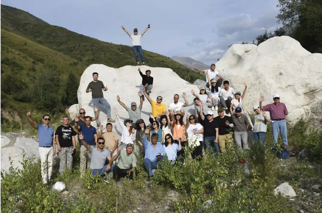
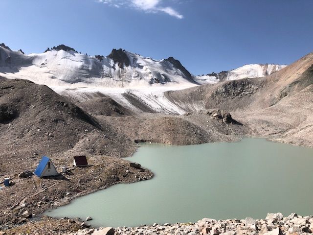
In the end of August 2022, a four days joint field visit was conducted to the various lakes close to the Adygene research station in the valley of Adygene, a western tributary to the Ala Archa river and valley. A team of scientists from the Kyrgyz Academy of Science’s Institute of Water Problems and Hydroenergy, the Swiss University of Zurich and visiting female students from various Kyrgyz universities spent three nights at Adygene research station. The team conducted bathymetrical surveys for the upper and lower Adygene lakes.

GLOFCA is present in ‘Adventure of Science: Women and Glaciers in Central Asia’

GLOFCA member Laura Niggli joined this year’s ‘Adventure of Science: Women and Glaciers in Central Asia’ (https://www.inspiringgirls.org/central-asia-en) expedition as visiting scientific instructor with expertise on Glacier Lake Outburst Floods.

The project ‘Adventure of Science’ empowers young women through science, art and wilderness exploration.

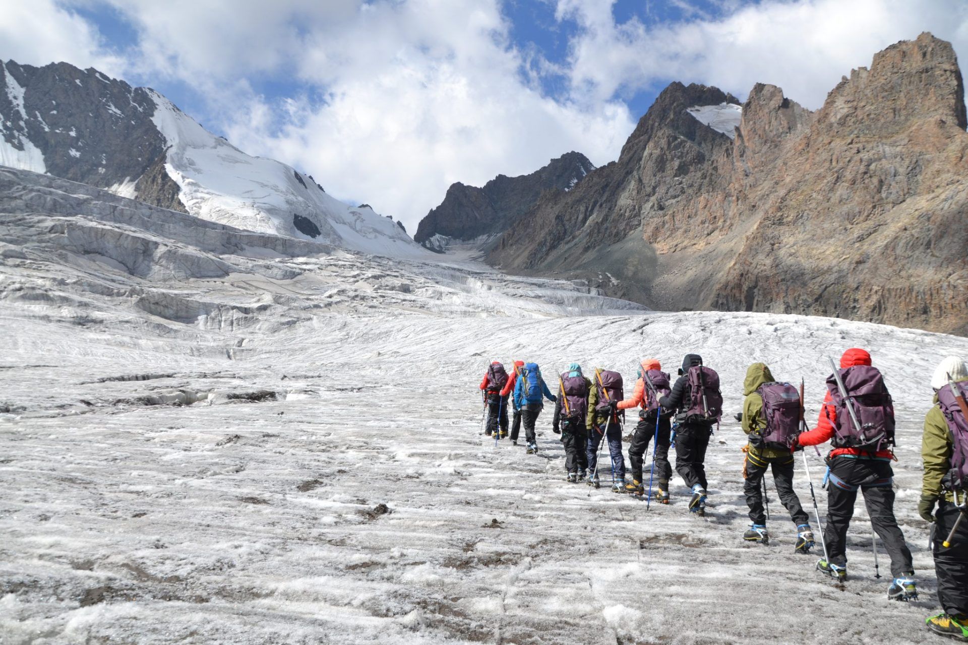
This year’s successful expedition took place from 16.-25. August 2022 in the adventurous Ala Archa National Park in Kyrgyzstan where the young women made their first steps in and around Golubin glacier located in the beautiful high mountain regions the Kyrgyz range.

The female led team trained the participants in scientific methods and supports them in the development and presentation of their own scientific projects. The participants learnt about climate and environmental changes as well as natural hazards and Disaster Risk Management (DRM) in high mountain regions.

Besides the focus on thematic capacity building, the program is designed to encourage critical thinking, curiosity, and expression with the goal to empower a new generation of strong, aware and educated female explorers, scientists and leaders.

Modelling Workshop with Project Partners and Zurich University in May and July 2022

The University of Zurich (UZH), in its role as lead implementing partner to the Executing Entity of UNESCO within the GLOFCA Project, organizes a technical training addressed to experts in the field of natural hazards management for the numerical modelling of rapid mass movements and glacier lake outburst floods in particular.A detailed prediction of the height, the velocity and the impact pressure of mass movements are the basis for natural hazard assessment.The software RAMMS was specially designed to provide practitioners with a tool that can be applied to analyze problems that cannot be solved with one-dimensional models.RAMMS is a reliable numerical simulation tool yielding runout distance, flow heights, flow velocities and impact pressure of dense flow snow avalanches, hillslope landslides, glacier lake outburst floods (GLOFs) and debris flows.link: httpss://ramms.slf.ch/ramms/

The course is divided in two introductory webinars and a face-to-face workshop, which will be held in Almaty. 

On the 16th of Mai 2022, the first webinar took place.The four panelist, Prof. Christian Huggel, Dr. Perry Bartelt, Dr. Holger Frey and Dr. Alessandro Cicoira introduced general topics from disaster risk reduction and numerical modelling of rapid mass movements. 
Examples from different continents and different types of mass movements were covered, including snow avalanches, rockfalls, and GLOFs.

A large audience of almost 50 experts from the four Republic in Central Asia participated to the training.

On the 1st of June, the second webinar took place.The participants heard about the challanges and the assumptions used in the model from Dr. Brian McArdel.Also, two examples of mass movements from the Swiss Alps were examined in detail to illustrate the functionality and the potential of the model.The participants had the chance to get training on how to deal with highly relevant objects and obstacles such as houses, but also with low friction areas, such as roads.

Thanks to all the organizers from the UNESCO Almaty, the University of Zurich, the WSL-SLF institute, the translators, and all the interested participants, the two events were a success.These two webinars pave the road for the upcoming workshop that will be held in Almaty from the 27th to the 30th of June.There, the participants will have the opportunity to work with international experts on GLOFs modelling, follow hands-on exercises, and autonomously develop their own study cases. 

​​​​On the last week of July 2022, 23 participants from the four Central Asia Republics participated in a training on numerical modelling of Glacier Lake Outburst Floods (GLOF). 

The event was organized by the University of Zurich (Alessandro Cicoira), the Snow and Avalanche Research Centre SLF in Davos (Perry Barlet, Jessica Munch, Olga Gorynina) and the UNESCO office in Almaty (Natalia Kim and Gulnaz Abdaliyeva), with additional help of the State Institute Kazselezashita under Ministry of Emergency Situations of the Republic of Kazakhstan (Murat Kassenov).

The participants were accurately selected amongst national authorities, research centers and universities, where professional personnel is currently working for mitigating GLOF risk.

The participants had the opportunity to learn how to use the software RAMMS. During the first day, several lectures about flow dynamics, GLOF breaching and open access data provided the basis for the rest of the training. All the participants learnt how to simulate rapid mass movements. Despite some theory being indispensable, the workshop room got warmer up quickly due to the heat generated by the computers. By the morning of the second day, everybody knew how to obtain its own data and independently run a numerical simulation.

The second day of the training an interesting field visit led by Mr Murat Kassenov brought the participants to the catchment of Talgar. There, the experts from the State Institute Kazselezashita and from the University of Zurich discussed mitigation measures, GLOF dynamics and numerical modelling keeping in mind the potential and the limitations of the software used in the course. 

The following two days were very busy, with the participants working briskly in order to obtain the maximum out of this block course. Many simulations have been performed, including the four pilot sites of the GLOFCA Project. The participants also simulated successfully with the help of the teachers some other case studies relevant for their work. 

During the last day of the training, in a conference fashion, each country presented their own study cases, the success and the problems that they encountered during the course. Finally, official learning certificates were endorsed to the participants, who will continue to work with the software in their professional and academic life. The institutions participating to the course are now equipped with 4 years licenses and ongoing support for their work. 

The course served at providing the fundamental basis for numerical simulations of GLOFS, but it also worked as a very effective international networking platform, both on a professional and personal level. Many collaborations have been discussed already and more will likely follow, in the best interest of capacity building, development and cooperation.

В последнюю неделю июля 2022 года 23 участника из четырех республик Центральной Азии приняли участие в тренинге по численному моделированию паводков от прорыва ледниковых озер (ППЛО). 

Мероприятие было организовано Цюрихским университетом (Алессандро Чикойра), Центром исследований снега и лавин SLF в Давосе (Перри Барлет, Джессика Мунк, Ольга Горынина) и Кластерным бюро ЮНЕСКО в Алматы (Наталья Ким и Гульназ Абдалиева) при дополнительной помощи Государственного учреждения “Казселезащита” при Министерстве Чрезвычайных ситуаций Республики Казахстан.

Участники были тщательно отобраны среди национальных органов власти, исследовательских центров и университетов, где в настоящее время работают профессиональные кадры по снижению риска ППЛО.

Участники имели возможность научиться пользоваться программным обеспечением RAMMS. В течение первого дня лекции о динамике потока, ППЛО и данных открытого доступа послужили основой для остальной части тренинга. Все участники научились моделировать быстрые движения масс. Несмотря на то, что без теории было не обойтись, помещение семинара быстро нагревалось из-за тепла, выделяемого компьютерами. К утру второго дня все знали, как получить собственные данные и самостоятельно запустить численное моделирование.

На второй день тренинга состоялся интересный полевой выезд участников на водосборный бассейн Талгара под руководством г-на Мурата Касенова. Там эксперты из Государственного учреждения “Казселезащита” и Цюрихского университета обсудили меры по смягчению последствий, динамику ППЛО и численное моделирование, учитывая потенциал и ограничения программного обеспечения, используемого в курсе. 

Последующие два дня были очень насыщенными, участники работали в напряженном режиме, чтобы получить максимум от этого курса. Было проведено много симуляций, включая четыре пилотных территории проекта GLOFCA. Участники также успешно смоделировали с помощью преподавателей некоторые другие тематические исследования, имеющие отношение к их работе. 

В последний день тренинга, который прошел в форме конференции, каждая страна представила свои учебные примеры, успехи и проблемы, с которыми они столкнулись во время курса. Наконец, были вручены официальные сертификаты об обучении участникам, которые будут продолжать работать с программным обеспечением в своей профессиональной и академической жизни. Учреждения, участвовавшие в курсе, теперь обеспечены лицензиями на 4 года и постоянной поддержкой их работы. 

Курс послужил фундаментальной основой для численного моделирования ППЛО, а также стал очень эффективной платформой для налаживания международных связей, как на профессиональном, так и на межличностном уровне. Уже обсуждались многие вопросы сотрудничества, и, скорее всего, их станет еще больше, в интересах наращивания потенциала, развития и сотрудничества.
 

IPCC Report is out

The report published on February 28, 2022 is looking at ecosystems, biodiversity, and human communities at global and regional levels. It also reviews vulnerabilities and the capacities and limits of the natural world and human societies to adapt to climate change.

We are in the middle of a men made crises!

https://report.ipcc.ch/ar6wg2/pdf/IPCC_AR6_WGII_SummaryForPolicymakers.pdf

Press statement by the the Secretary General of the United Nations, Antonio Guterres