
News Category: Risk Management

The GLOFCA Project Supports Construction of a Debris Diversion Channel in Tuura-Suu Village, Kyrgyz Republic

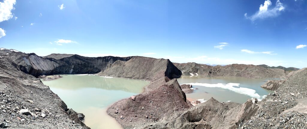
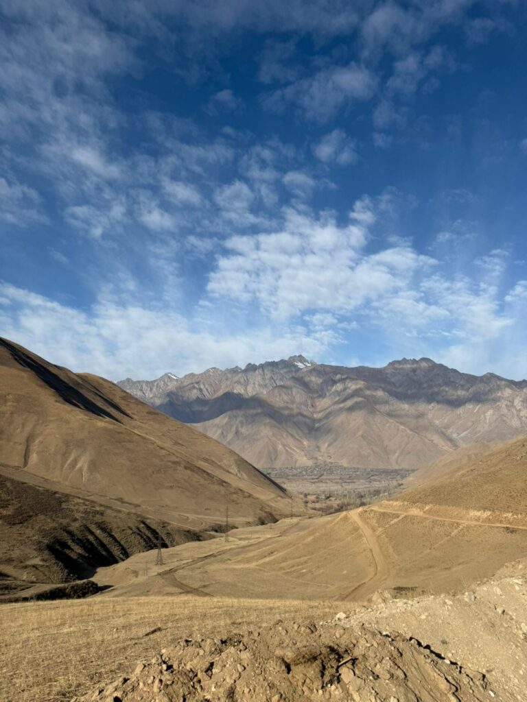
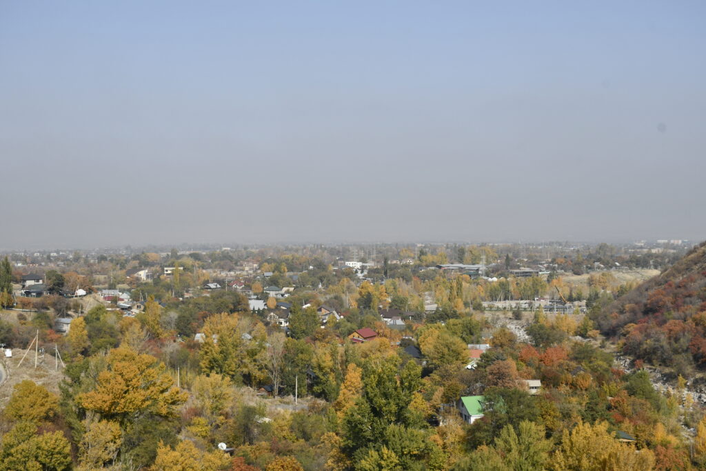
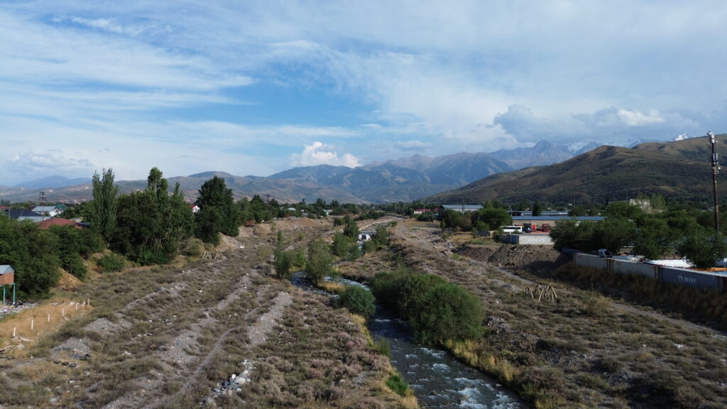
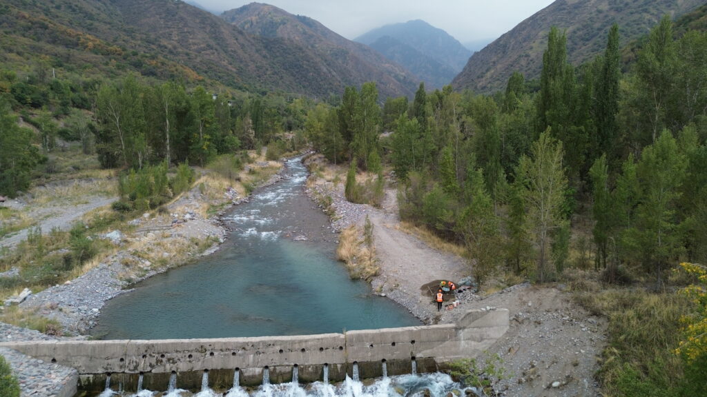
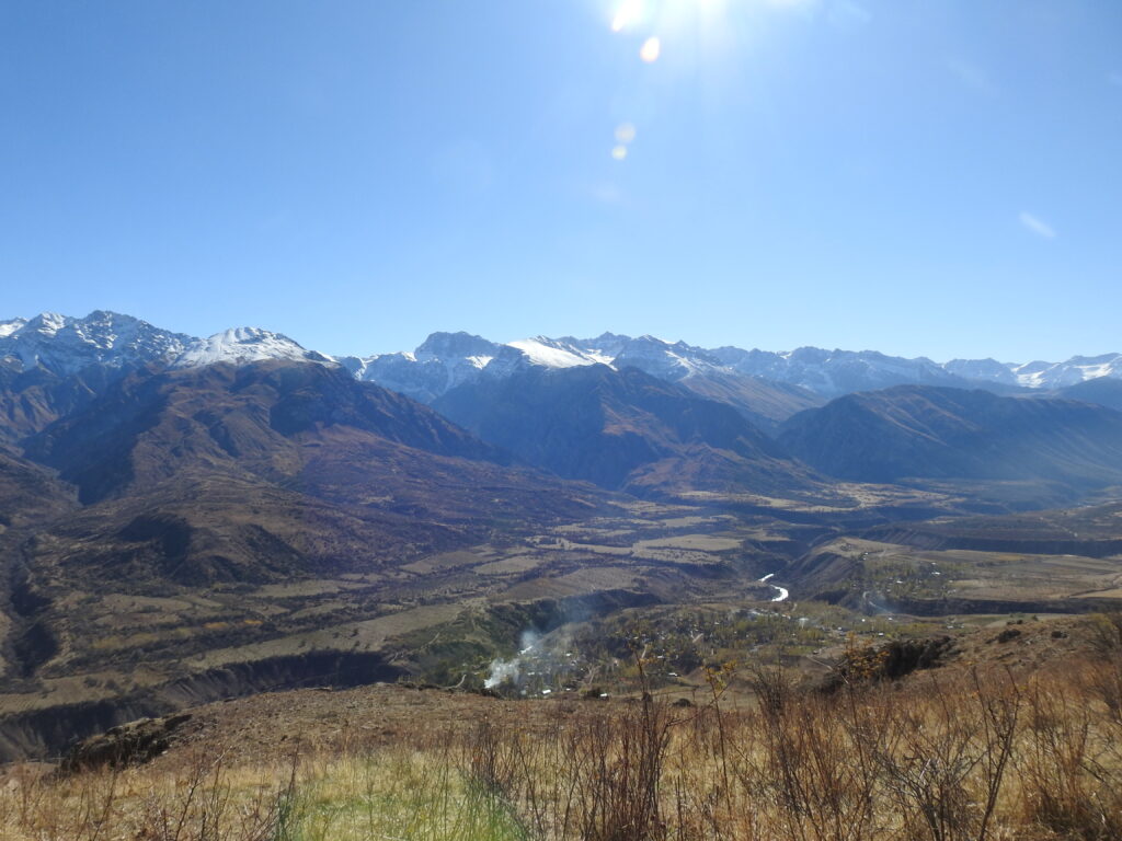
In the Kyrgyz Republic, one of the project’s pilot areas is the Ton River basin. The river originates on the northern slopes of the Terskey Ala-Too range and flows into Lake Issyk-Kul. Due to the presence of numerous potentially dangerous glacial lakes in its upper reaches, combined with intense precipitation, the basin is considered highly prone to debris flows.

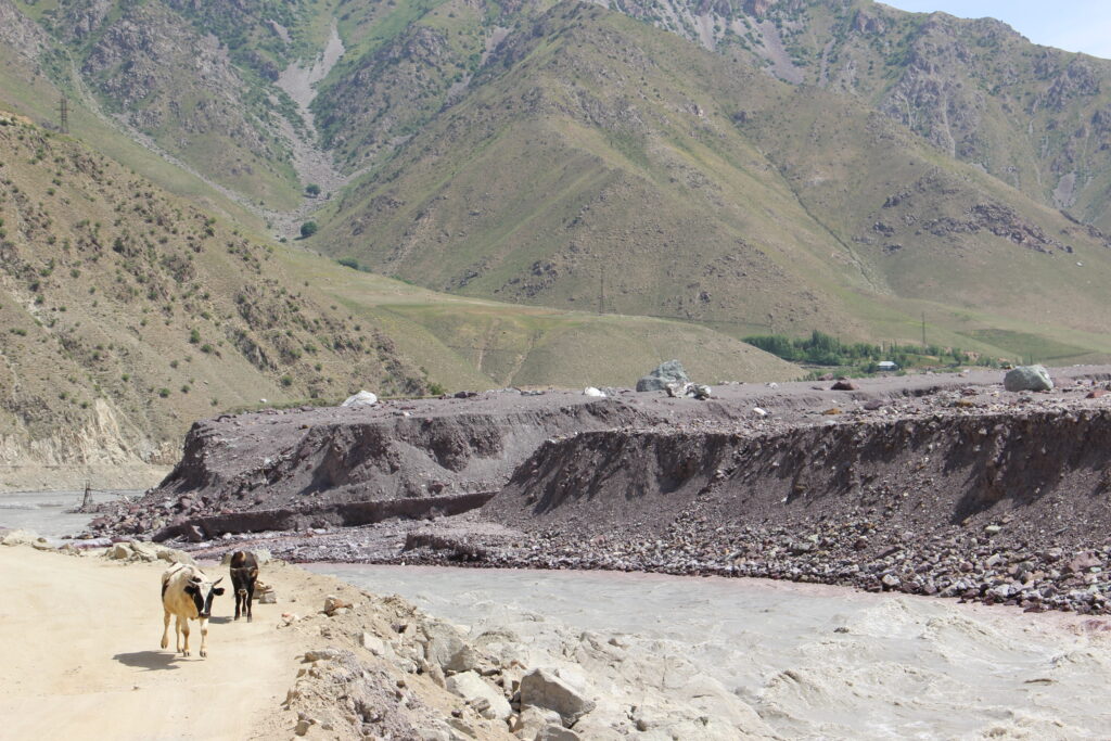
The lower section of the river, where the village of Tuura-Suu is located, remains particularly vulnerable. The basin has repeatedly experienced emergency situations linked to the outburst of high-mountain lakes. The most recent major event occurred in August 2024, when the outburst of Lake Zyndan caused a sharp rise in the Ton River’s water level, threatening residential buildings and local infrastructure. Thanks to the quick response of the Ministry of Emergency Situations of the Kyrgyz Republic (MES), the river channel was redirected and approximately 400 people were evacuated, preventing flooding of homes.

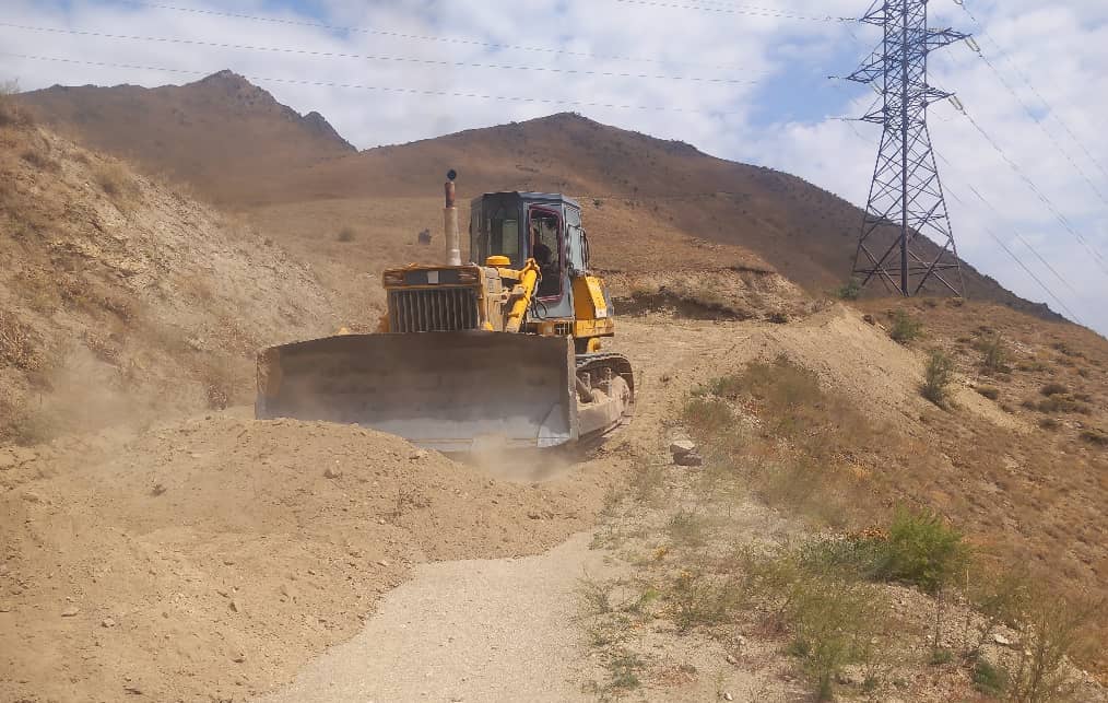
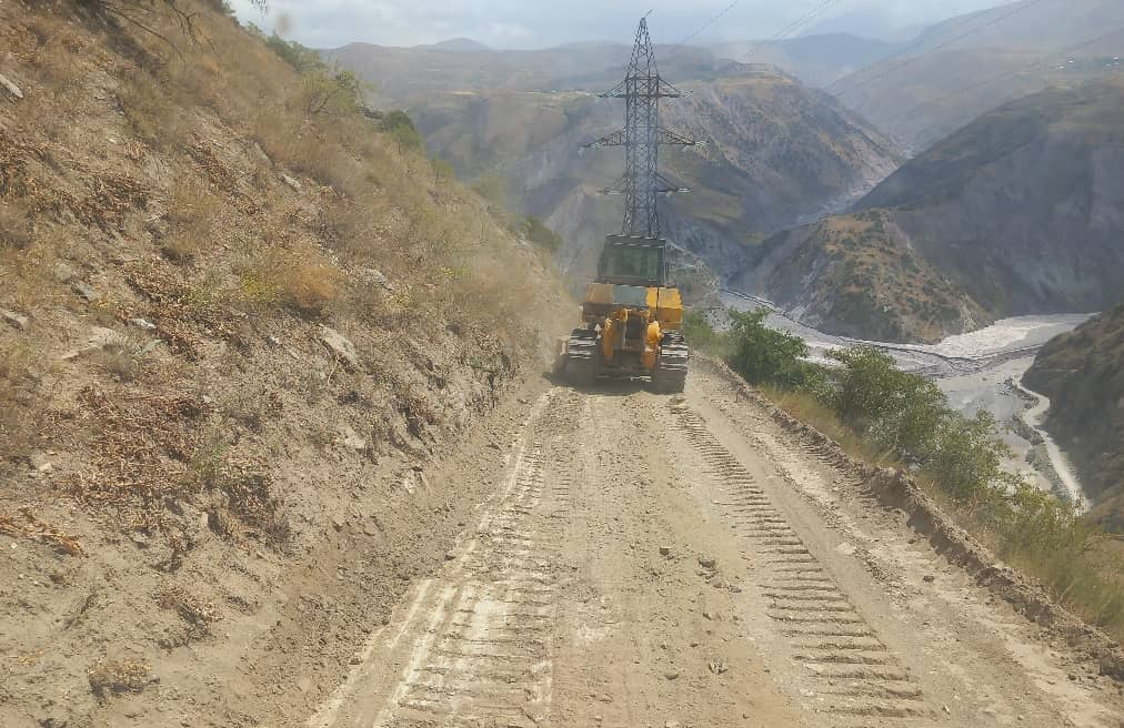
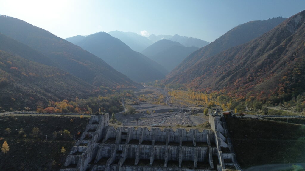
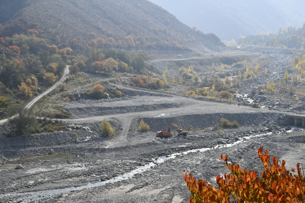
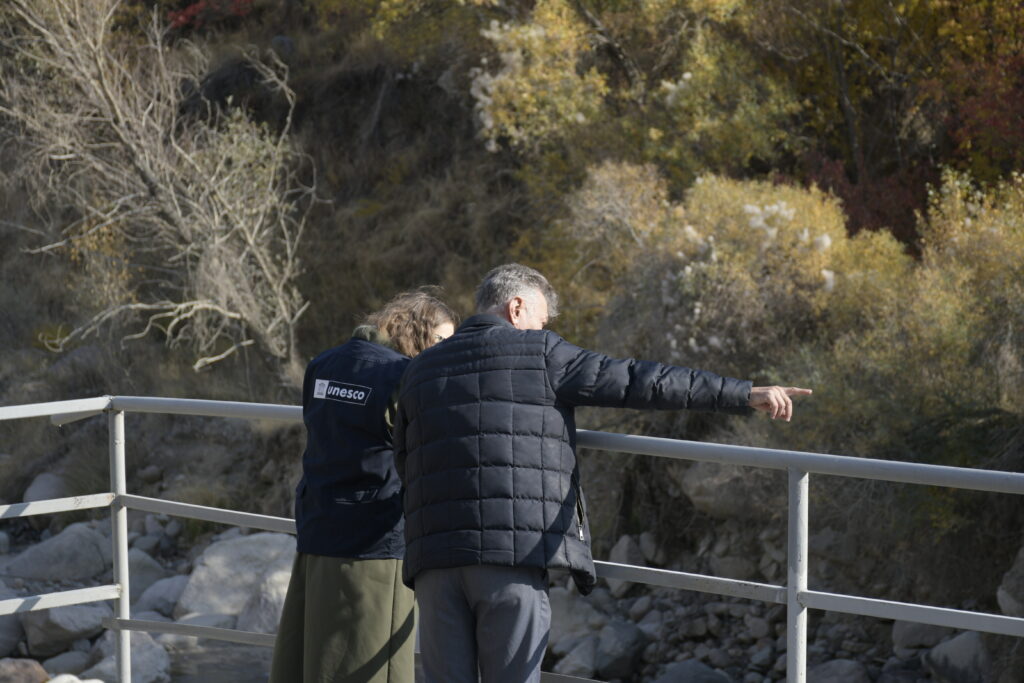
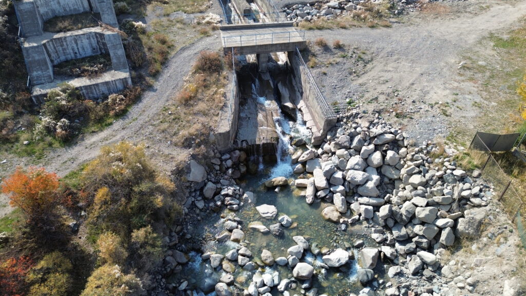
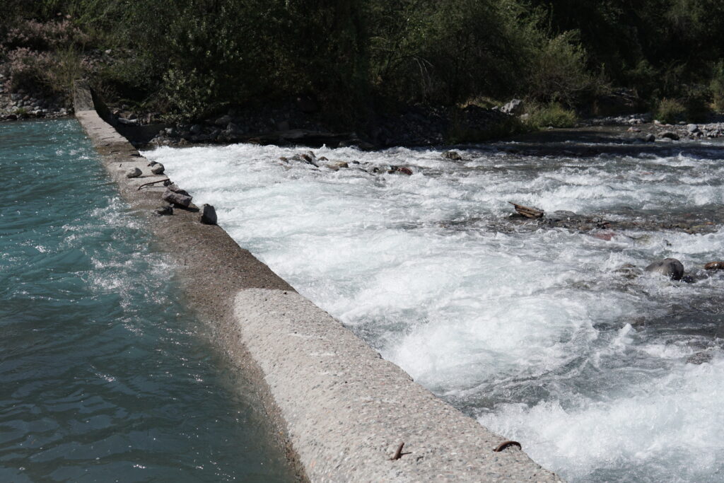
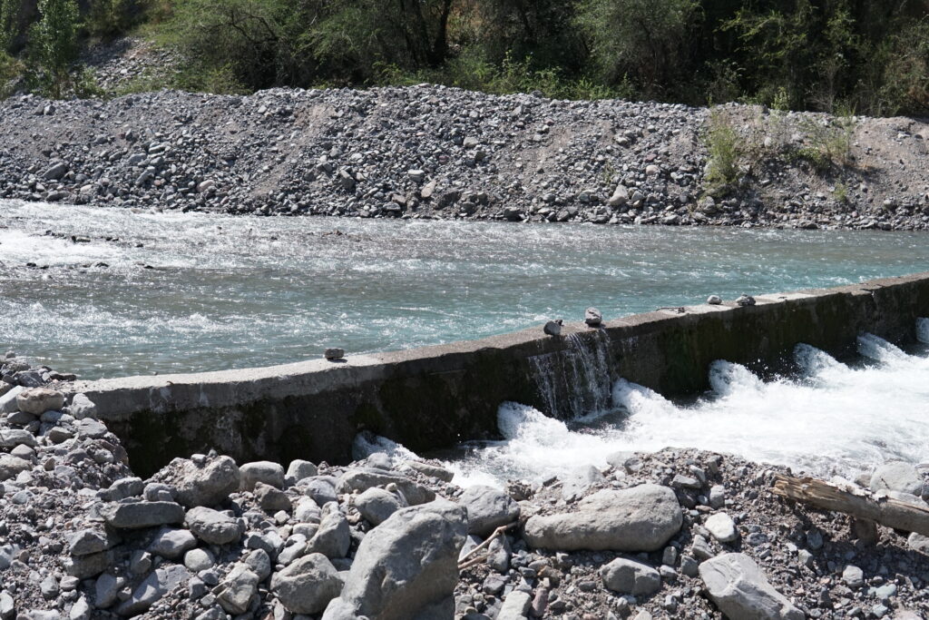
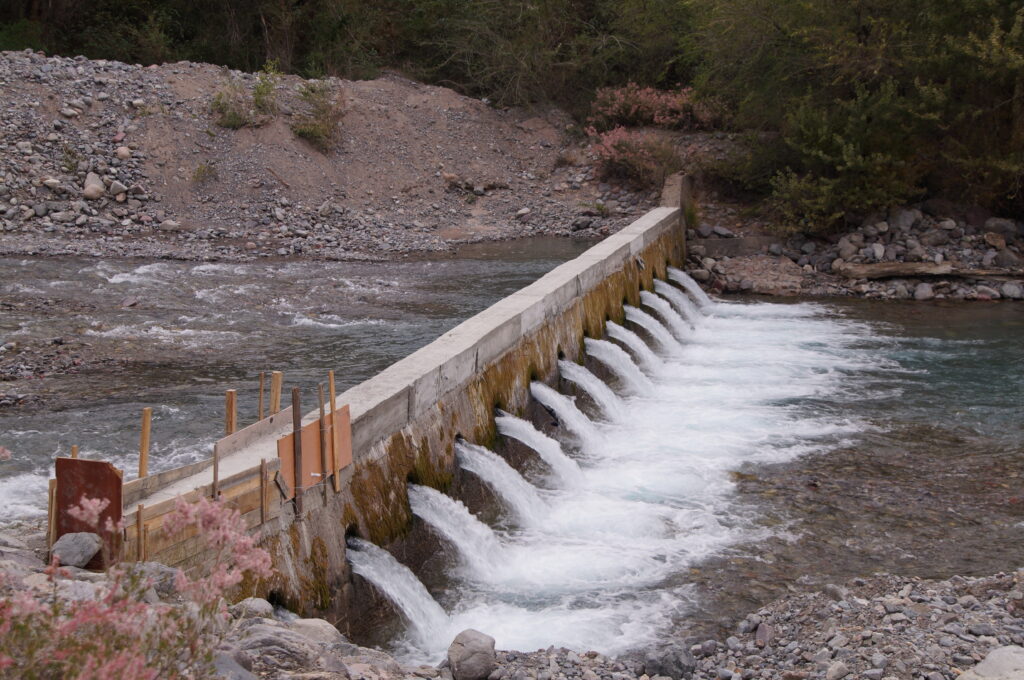
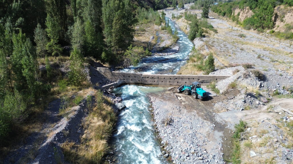
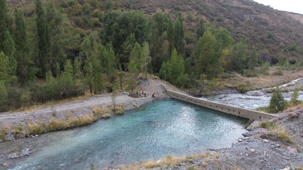
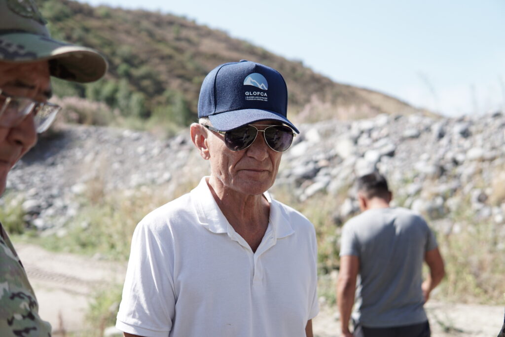
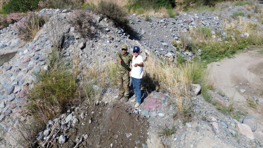
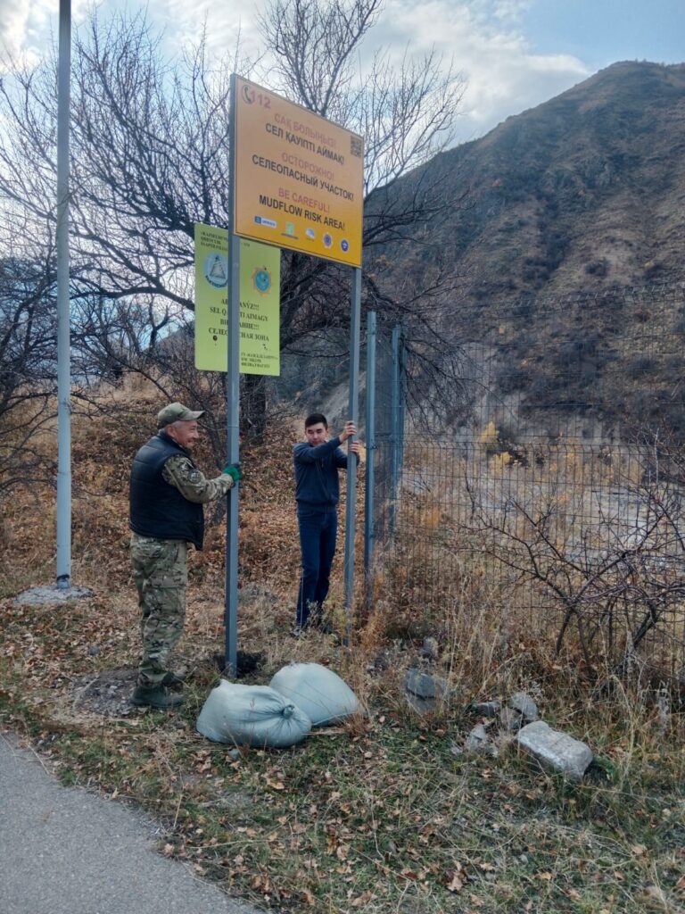
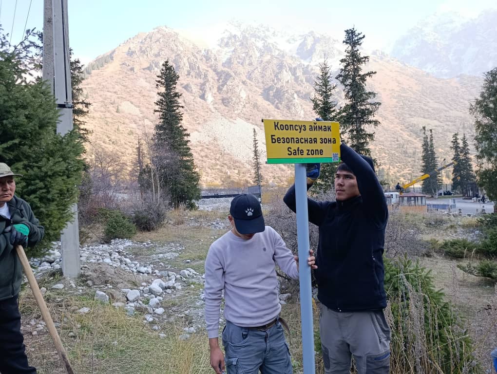
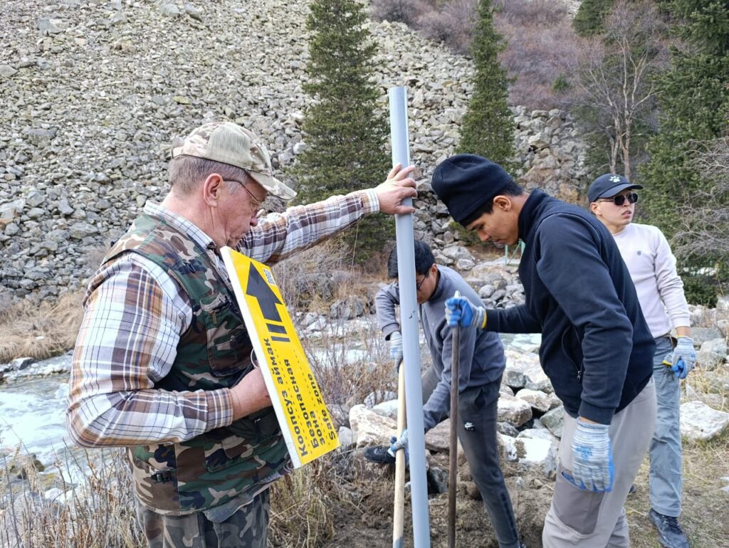
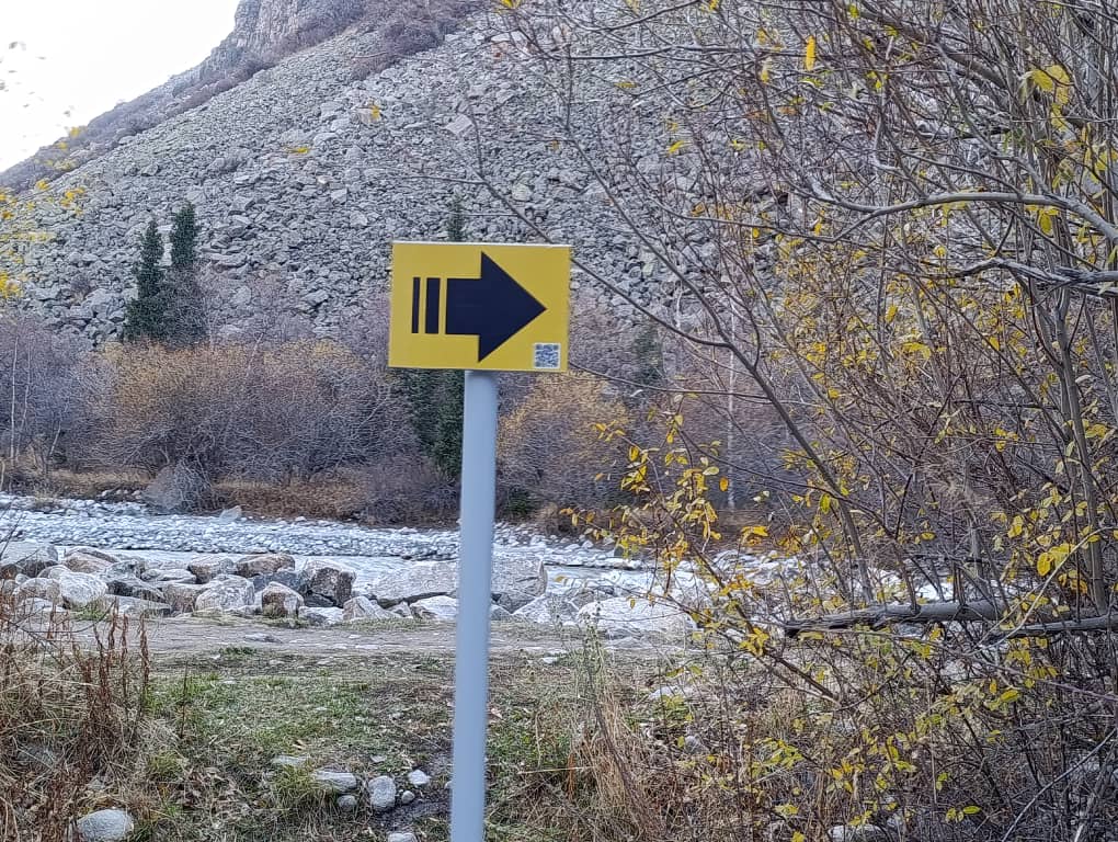
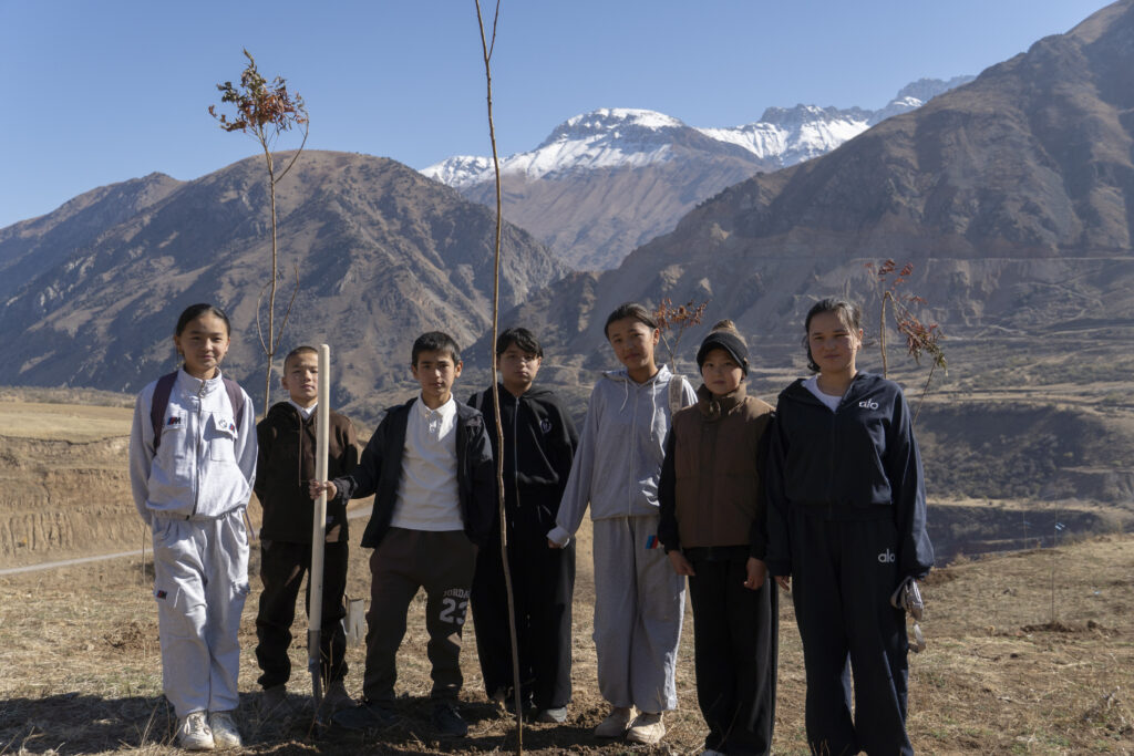
To enhance the safety of Tuura-Suu, the GLOFCA project, in cooperation with the MES, initiated the construction of a debris diversion channel. The channel will redirect debris flows away from the settlement, thereby reducing risks to residential areas as well as to the Bishkek–Karakol highway, an important transport corridor. The initiative has received strong support from local residents, and the local administration actively facilitated the implementation of the construction works.

Embankment construction for the diversion channel

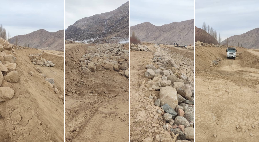
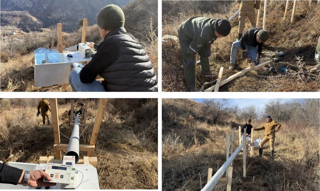
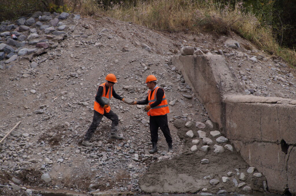
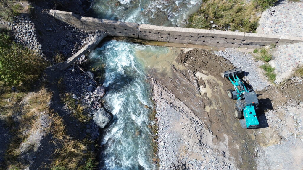
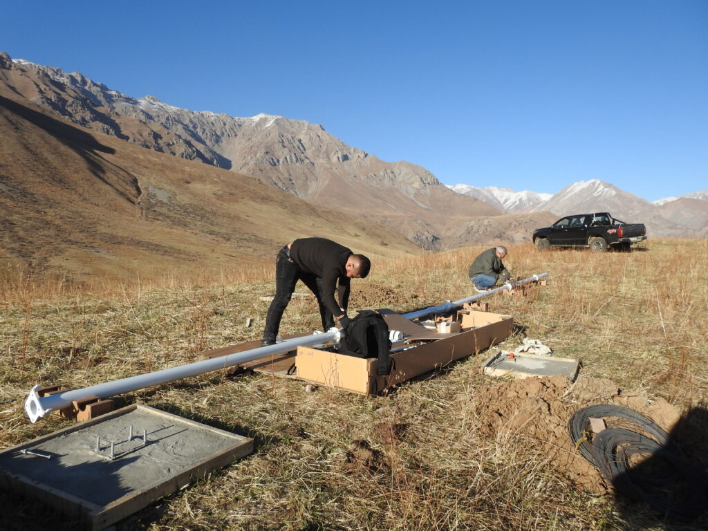
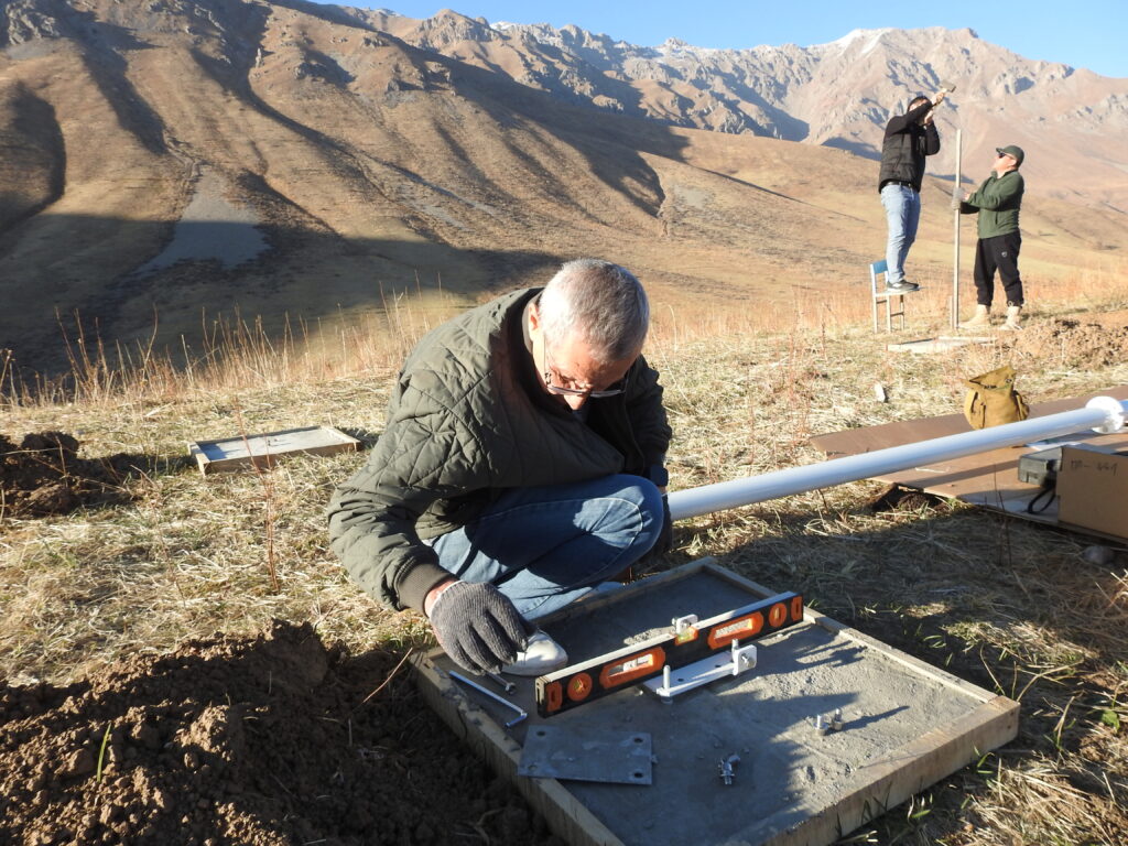
As part of the project, geodetic surveys were conducted, the foundation for the diversion channel was prepared, and embankment works were completed. In the near future, awareness-raising and preparedness drills will also be organized for the local population.

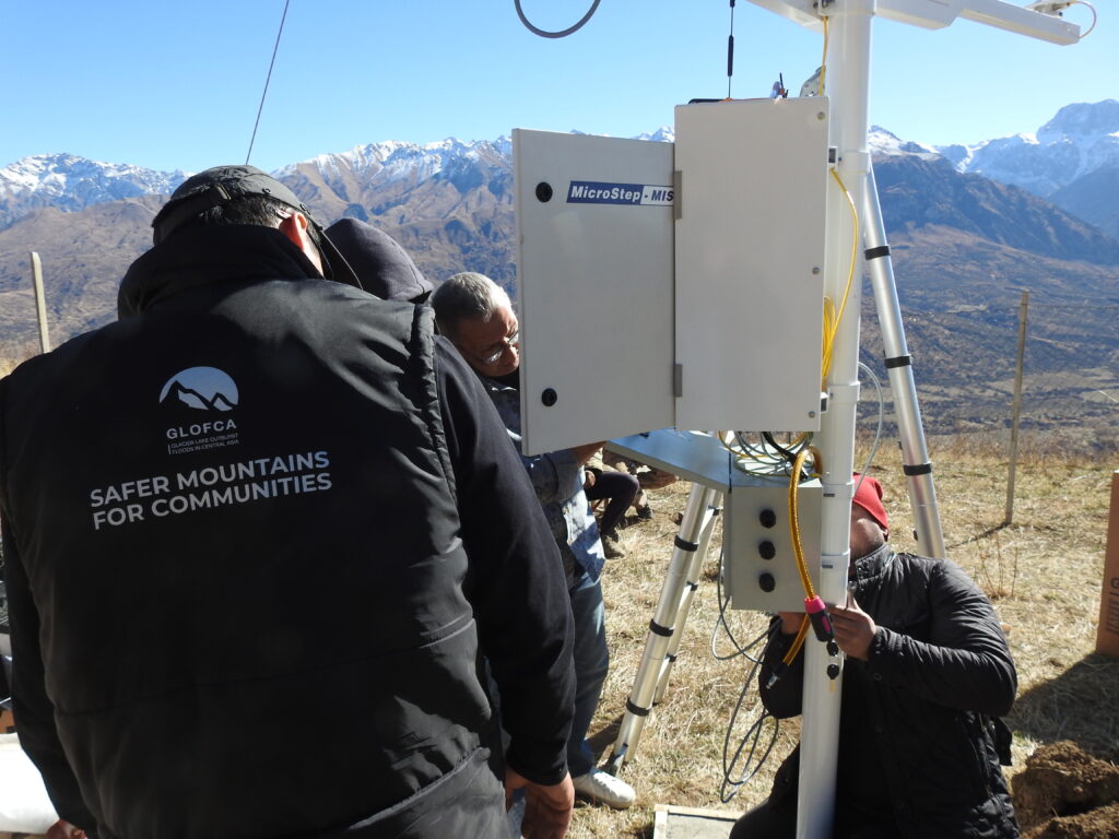
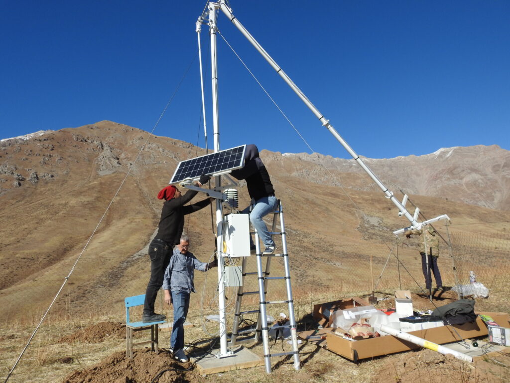
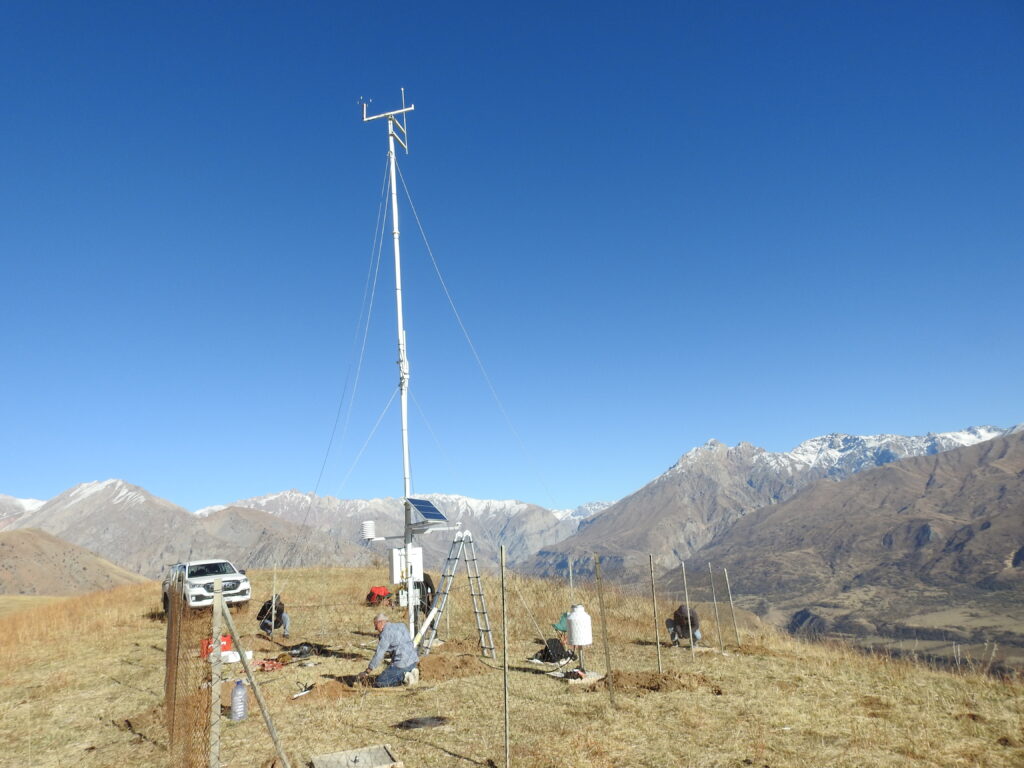
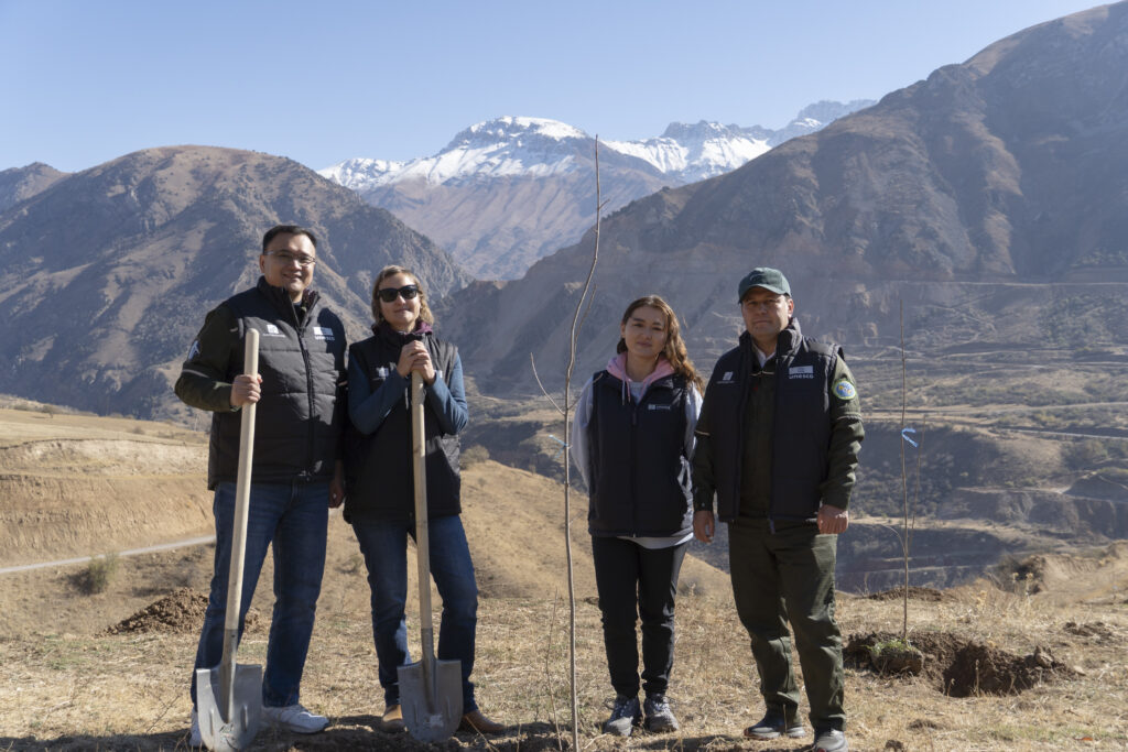
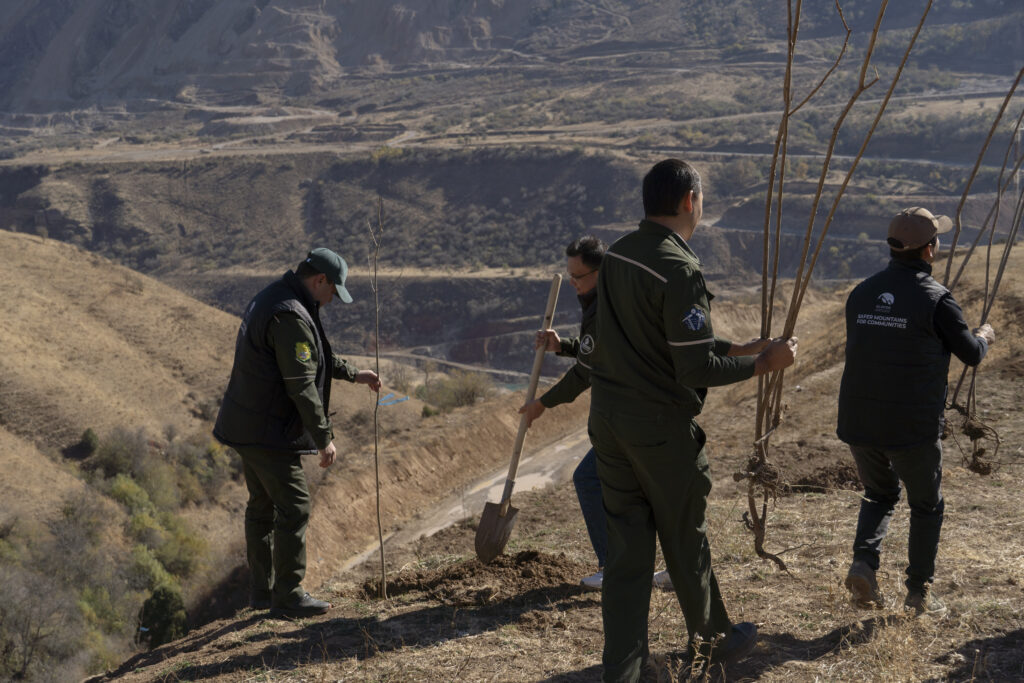
The measures in the Ton River basin are part of the broader regional GLOFCA project, which aims to strengthen the resilience of pilot territories in Central Asia to the risks of glacial lake outburst floods.

GLOFCA in Tajikistan: strengthening an alternative road in Lakhsh district

One of these measures focuses on improving an existing alternative road between the villages of Korvonguzar and Duagba, including widening the carriageway and laying a gravel surface.

Lakhsh district is classified as a high-risk area where mudflows, landslides and floods occur regularly. The upper parts of the district host several glacier lakes, including those located in the lower section of the Said Nafisi (formerly Baralmos) Glacier. Outbursts from these lakes periodically damage sections of the main road running along the Surkhob River.

Glacial lakes, Said Nafisi (formerly Baralmos) Glacier

In such situations, the alternative road between Korvonguzar and Duagba remains the only transport link, providing access to medical and emergency services. It ensures connectivity for more than 20 settlements in Lakhsh district, with a total population exceeding 20,000 people, including communities in border areas with the Kyrgyz Republic. Previously, this route was in poor condition and did not provide reliable access, particularly during adverse weather conditions.

The road along the Surkhob river

To improve safety and accessability, the GLOFCA project supported road improvement works. Prior to construction, specialists conducted an engineering assessment to identify sections most exposed to water impact and erosion. Then the road was widened, the surface levelled, and gravel laid on the most problematic sections. These measures aim to ensure more reliable, year-round access between settlements.

Further works are planned for vulnerable sections, including the installation of drainage structures to channel meltwater and rainwater and reduce the risk of road washout. Some additional measures are scheduled for the warmer season, when weather conditions will allow continued reinforcement of the route.

In spring, slope greening is also planned along the alternative road. Tree planting will help stabilize soils, reduce erosion, and increase the road’s resilience to water impacts, combining engineering solutions with nature-based approaches.

The works in Lakhsh district form part of the broader objective of the GLOFCA project to reduce climate-related risks by strengthening infrastructure and enhancing the resilience of communities living in high-mountain areas under changing climate conditions.

Landslide monitoring devices installed in Uzbekistan to strengthen monitoring in the Pskem area

The Pskem Valley is a remote mountainous region exposed to frequent mudflows and landslides. Within the GLOFCA project, activities are being carried out at pilot sites in the villages of Pskem and Tepar. In December 2025, five extensometers (landslide monitoring devices) were installed at two of the most landslide-prone locations, Khirabulak and Takayangak, to strengthen local monitoring capacity.

According to technical assessments by the Institute of HYDROENGEO, the Khirabulak site shows a high level of landslide activity. The area is affected by deep tensile cracks in the upper slope sections, active surface and subsurface runoff, soil saturation, erosion processes, and the emergence of spring water at the landslide head. These factors create a serious risk for nearby settlements and infrastructure. Continuous monitoring using extensometers is essential to detect early signs of accelerated ground movement and support timely preventive action.

Takayangak Site is assessed as a medium level of risk and classified as a hazardous area due to steep slopes, loose soils sensitive to precipitation, seasonal groundwater fluctuations, and the presence of residential buildings and infrastructure within the potential impact zone. Landslide processes at this site may develop abruptly, particularly during periods of intense snowmelt and rainfall. Landslide activity here may intensify rapidly during periods of snowmelt or heavy rainfall. While the overall activity is lower than in Khirabulak, regular monitoring remains critical to reduce the risk of damage to roads, agricultural land, and local livelihoods.

The installed extensometers will enable accurate data collection on ground displacement, support early identification of landslide activation, and improve preparedness and response. This will enhance safety for local communities and provide a technical basis for future engineering and protective interventions. The monitoring system is an integral part of broader natural hazard risk management efforts under the GLOFCA project and helps reduce the vulnerability of exposed mountain territories in Uzbekistan.

GLOFCA Project Completes Engineering Works in Talgar, Kazakhstan

In Almaty Region, the project “Reducing vulnerabilities of populations in Central Asia region from glacier lake outburst floods in a changing climate” (GLOFCA), implemented by UNESCO with support from the Adaptation Fund, has completed reconstruction works in the Talgar River basin, one of the project’s pilot sites.

The Talgar River originates from the Ile Alatau glaciers and flows through several settlements, including the city of Talgar. The Talgar dam, built in the mid-2000s and operational since 2005, was affected by debris-flow events in 2023–2024. An assessment by Kazselezaсhita found that the plunge pool had filled with sediment and several structural elements were damaged, increasing the risk of uncontrolled floodwater passage and highlighting the need for timely rehabilitation.

“The dam has been operating for 20 years. Each year, conditions arise that lead to mudflows and flood surges, which wear down and partially damage the structure. During the hazardous period, the left slope was affected, posing a risk to nearby residential areas. Under the GLOFCA project, reinforcement work was carried out to stabilize the banks,” said Erik Barangaziyev, Director of Krystroy LLP, the company that implemented the reconstruction works.

The works included clearing and relocating more than 3,000 m³ of stones and boulders, strengthening slopes with a one-metre-thick stone layer and restoring concrete elements. These measures restored the dam’s discharge capacity, improved its resilience to future flood events and prevented further degradation.

In addition to engineering interventions, four warning signs and one information board with a debris-flow hazard map have been installed in the Talgar basin to enhance awareness among residents and visitors about natural hazards and recommended safety measures.

GLOFCA Project Completes Engineering Works in Esik, Kazakhstan

In Almaty Region, the project “Reducing vulnerabilities of populations in Central Asia region from glacier lake outburst floods in a changing climate” (GLOFCA), implemented by UNESCO with support from the Adaptation Fund, has completed a set of restoration works in the Esik River basin, one of the project’s pilot sites.

Esik river passing through the city of Esik

The Esik River is fed by the Ile Alatau glaciers, and its upper reaches contain the high-mountain Yesik Lake, a major tourist destination. Despite its scenic landscape, the area is classified as highly prone to mudflows and GLOFs. The upper basin contains moraine-dammed lakes and potential initiation zones, while downstream lies the city of Esik with a population of more than 40,000 people. The town has already experienced tragic events: a major debris flow in 1967 resulted in loss of life.

To protect the city, a system of ten low-pressure dams was built on the river in 1988. In 2022, a severe flood led to the filling of debris-retention basins and to partial dam failures. A 2025 assessment by Kazselezaсhita identified washed-out slopes, damaged dam sections and fully silted basins, requiring urgent restoration to prevent further degradation. Considering the population density in the lower basin, timely reinforcement of the protective structures was essential.

As part of the GLOFCA project’s complementary measures, a set of engineering works was carried out jointly with Krystroy LLP and Kazselezaсhita.

At low-pressure dam No.1, 3,300 m³ of debris was removed, the concrete structure was reinforced and the retaining wall restored. At dam No.4, more than 3,000 m³ of large stone material was excavated and relocated, the slopes were stabilized with a one-metre stone layer and the riverbed was levelled. These interventions restored the dams’ discharge capacity and reduced the risk of further erosion.

According to Erik Barangaziyev, Director of Krystroy LLP, the works were carried out to enhance the safety of the city of Esik and increase the resilience of protective infrastructure to future floods and mudflows.

In addition, four warning signs and one information board with a mudflow hazard map were installed in the Esik basin. These help raise awareness among local residents and tourists about natural hazards and recommended safety measures.

The reconstruction works have been completed. The reinforced protective structures are now ready to safely pass floodwaters during periods of increased risk.

An Automatic Weather Station Installed in Uzbekistan to Strengthen Monitoring in the Pskem Area

In Tashkent Region, Uzbekistan, the project “Reducing vulnerabilities of populations in Central Asia region from glacier lake outburst floods in a changing climate” (GLOFCA), implemented by UNESCO with support from the Adaptation Fund, has completed the installation of an automatic meteorological station near the village of Pskem — one of the project’s pilot sites.

The Pskem area is a remote mountain region exposed to intense precipitation, debris flows, landslidesб and rockfalls. The upper reaches of the river contain glacial lakes, while mountain settlements, including Pskem and Tepar villages, as well as hydropower infrastructure, are located along the valley. In such conditions, a reliable monitoring system plays a crucial role in reducing risks.

To improve the quality of observations, a modern automatic station was installed, providing continuous data on temperature, humidity, precipitation, wind, solar radiation and soil conditions. This information is vital for assessing debris-flow and landslide hazards.

The installation was carried out by specialists of the H.M. Abdullaev Institute of Geology and Geophysics together with the Hydrometeorological Research Institute (NIGMI). After installation, the weather station was integrated into the Uzhydromet network and began transmitting real-time data.

The new station significantly strengthens the monitoring system in the Pskem area and provides national services with accurate information for risk management, contributing to greater safety for local residents and visitors to the region.

New information boards in Ala-Archa National Park: a step towards visitor safety

In one of Kyrgyzstan’s most visited natural areas — Ala-Archa National Park — new information boards have been installed to enhance the safety of tourists and local residents. The initiative was implemented under the UNESCO–Adaptation Fund project “Reducing vulnerabilities of populations in Central Asia from glacier lake outburst floods in a changing climate (GLOFCA)”.

Located near the capital Bishkek and traversed by the Ala-Archa River, the park is one of the country’s most scenic sites, home to rich flora and fauna. It receives around 6,500 visitors daily during the summer (according to 2025 data), and up to 7,000 in autumn. Given such high visitation and the elevated risk of natural hazards — particularly mudflows — the installation of warning signs represents an important step towards improving safety.

The park has previously experienced destructive mudflows: in 2003, a major event destroyed forested areas, and new incidents were recorded in 2015. The affected territory of around 500–600 m² was later rehabilitated.

As part of the GLOFCA project, locations for the boards and designated safe assembly points were identified jointly with park staff. The signs were installed in three key zones — Ak-Sai, Adygene, and the lower Ala-Archa valley. They include warnings in Kyrgyz, Russian, and English, show evacuation routes, and feature QR codes linking to detailed information on natural hazards and safety measures.

The next phase of the GLOFCA project will include the installation of an Early Warning System to provide timely alerts to visitors and park authorities about potential glacier lake outburst floods and mudflows.

Major collapse of the Dehdal Glacier

On 25 October 2025, at around 11:00 a.m., a large ice mass collapsed from the Dehdal Glacier (formerly known as Dedal), located on the northern slopes of the Peter the First Range, near the village of Safedobi in Tajikabad District.

According to the Committee for Emergency Situations and Civil Defence under the Government of the Republic of Tajikistan, a section of the glacier, approximately 2 km long, 25 m high, and 150–200 m wide, broke off and slid down the valley. By 14:00, the situation had stabilized, and no casualties or serious damage were reported.

This is the second collapse of the Dehdal Glacier in recent months. Kamoliddin Nazirzoda, Deputy Head of the Glaciology Centre of the Agency for Hydrometeorology of Tajikistan, explained:

“The activity of the Dehdal Glacier this year can be described as abnormal — no one expected a surge. This glacier is listed among the representative glaciers, and our Centre assessed its condition in 2020 and 2024. According to those studies, there were no signs of an imminent surge; we expected it in 25–30 years. However, this year two surges occurred in a row: the first on 18–19 September, when the glacier advanced more than 4 km, and the second at the end of October, when the ice mass moved another 5 km down the valley. Satellite images show that the activity had already started in early September.”

About the glacier

The Dehdal Glacier originates at an altitude of 4,600 metres above sea level and is a surge-type (or pulsating) glacier, whose movement occurs roughly every 40–45 years, according to the Glaciology Centre of the Agency for Hydrometeorology. Previous active phases of Dehdal were recorded in 1902, 1922, 1974, and 2016.

According to Kamoliddin Nazirzoda, the glacier’s dynamics are directly linked to climatic conditions — namely, the amount of precipitation and snow accumulation in its feeding area.

“After analyzing meteorological data from the past five years, we found that from late spring to early autumn this year, there was almost no precipitation, while temperatures remained high. This led to the degradation of the glacier’s structure. Another contributing factor was seismic activity. Several earthquakes were recorded in the area this year, which could also have influenced the movement of the ice mass.”

Outlook

The glacier’s surface remains active. The residual glacier continues to move forward at speeds of up to 40 metres per day, and there is a risk that another detachment could occur. There is also a risk that the ice mass and sediment accumulated downstream in the valley may subside during heavy rainfall, snowfall, potentially blocking the river channel flowing from the glacier. In this case, a temporary lake could form, and its outburst might damage the bridge on the Dushanbe–Vakhdat–Lakhsh highway leading to the Kyrgyz Republic, as well as affect farmland in the village of Gulrez.

According to the Committee for Emergency Situations, work is already underway in the valley to reinforce riverbanks and protect the bridge and nearby areas in case of new surges or water outbursts.

“We continue monitoring the glacier. In the coming days, our specialists will travel to the site to assess the likelihood of another surge,” added Kamoliddin Nazirzoda.

Why it matters

The recent glacier collapse highlights the urgent need to strengthen disaster risk reduction and establish early warning systems to protect mountain communities – efforts currently being implemented by the “Reducing vulnerabilities of populations in Central Asia from glacier lake outburst floods in a changing climate” (GLOFCA) project near the Said Nasifi (Baralmos) Glacier.

GLOFCA project and partners planted 800 trees in the Pskem Valley to protect against landslides and held a children’s drawing contest

This October, the team of the UNESCO–Adaptation Fund project “Reducing vulnerabilities of populations in the Central Asia region from glacier lake outburst floods in a changing climate” (GLOFCA) and the State Institution “Hydroingeo” organized a large-scale tree-planting campaign in the Pskem Valley of the Tashkent region, one of the project’s pilot sites. The initiative aimed to stabilize slopes and protect local communities from landslides – one of the most serious natural hazards in the area.

The Pskem Valley is prone to multiple natural hazards, with landslides posing the greatest threat. The most recent large-scale event occurred in 2017 in the Khirabulak area, when a landslide with a volume of around one million cubic metres destroyed a road and hundreds of trees. The valley is home to more than 2,000 residents, including in the villages of Pskem and Tepar, both pilot sites of the GLOFCA project.

The GLOFCA project in collaboration with Hydroingeo carried out tree planting in two landslide-prone areas – Ispai-Tepar and Khirabulak – planting a total of 800 trees. Sumac and poplar species were selected for their deep root systems, which help strengthen the soil and prevent erosion. This campaign was part of the project’s complementary adaptation measures to enhance the resilience of local communities.

The closing event on 30 October brought together representatives of UNESCO, Hydroingeo, the Ministry of Mining Industry and Geology, the Research Hydrometeorological Institute (NIGMI), Institute of Geology and Geophysics named after Kh. M. Abdullaev, as well as residents and schoolchildren from the villages of Tepar and Pskem.

The campaign concluded with an award ceremony for students who participated in GLOFCA’s art contest on disaster risk reduction. One of the winners, fifth-grade student Usmonov Zhasur from School No. 45 in Pskem, presented a prototype of an automated excavator for clearing riverbeds after natural disasters such as mudflows, earning him first place in the competition.

The active involvement of students in the contest and tree planting reflected their growing awareness of natural hazards and their dedication to protecting their home communities.

Tree planting, slope monitoring, and community engagement form an integral part of the GLOFCA project’s efforts to reduce vulnerability to natural hazards and strengthen the resilience of mountain communities in Uzbekistan.