Landslide monitoring devices installed in Uzbekistan to strengthen monitoring in the Pskem area

The Pskem Valley is a remote mountainous region exposed to frequent mudflows and landslides. Within the GLOFCA project, activities are being carried out at pilot sites in the villages of Pskem and Tepar. In December 2025, five extensometers (landslide monitoring devices) were installed at two of the most landslide-prone locations, Khirabulak and Takayangak, to strengthen local monitoring capacity.
According to technical assessments by the Institute of HYDROENGEO, the Khirabulak site shows a high level of landslide activity. The area is affected by deep tensile cracks in the upper slope sections, active surface and subsurface runoff, soil saturation, erosion processes, and the emergence of spring water at the landslide head. These factors create a serious risk for nearby settlements and infrastructure. Continuous monitoring using extensometers is essential to detect early signs of accelerated ground movement and support timely preventive action.
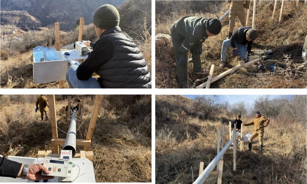
Takayangak Site is assessed as a medium level of risk and classified as a hazardous area due to steep slopes, loose soils sensitive to precipitation, seasonal groundwater fluctuations, and the presence of residential buildings and infrastructure within the potential impact zone. Landslide processes at this site may develop abruptly, particularly during periods of intense snowmelt and rainfall. Landslide activity here may intensify rapidly during periods of snowmelt or heavy rainfall. While the overall activity is lower than in Khirabulak, regular monitoring remains critical to reduce the risk of damage to roads, agricultural land, and local livelihoods.
The installed extensometers will enable accurate data collection on ground displacement, support early identification of landslide activation, and improve preparedness and response. This will enhance safety for local communities and provide a technical basis for future engineering and protective interventions. The monitoring system is an integral part of broader natural hazard risk management efforts under the GLOFCA project and helps reduce the vulnerability of exposed mountain territories in Uzbekistan.
Read more

The GLOFCA project hands over an improved alternative road to strengthen disaster resilience in Lakhsh District

Early warning system for Talgar River basin successfully tested ahead of installation
