
Pilot Site
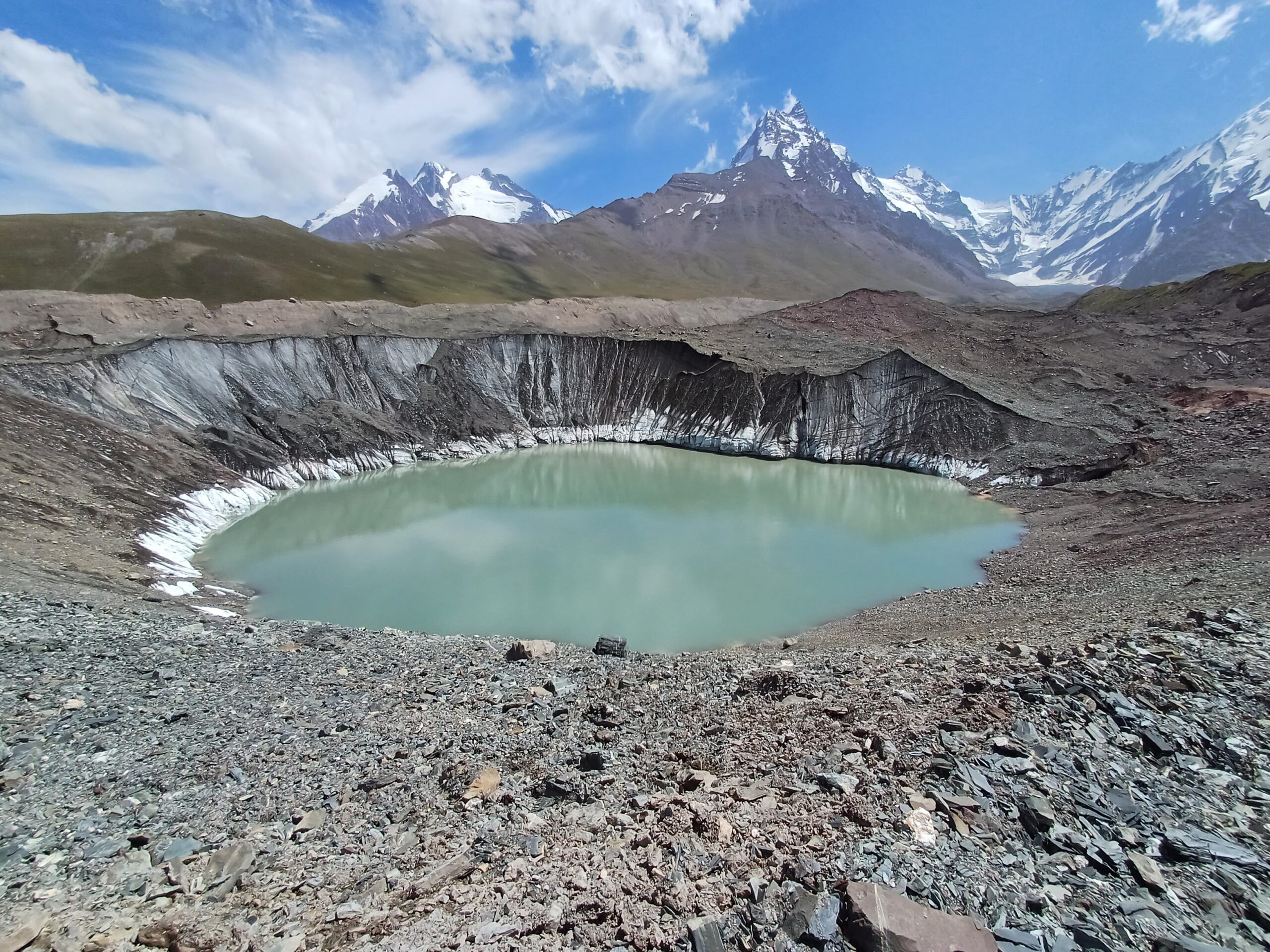
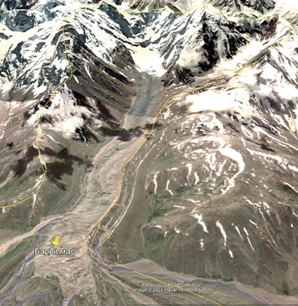
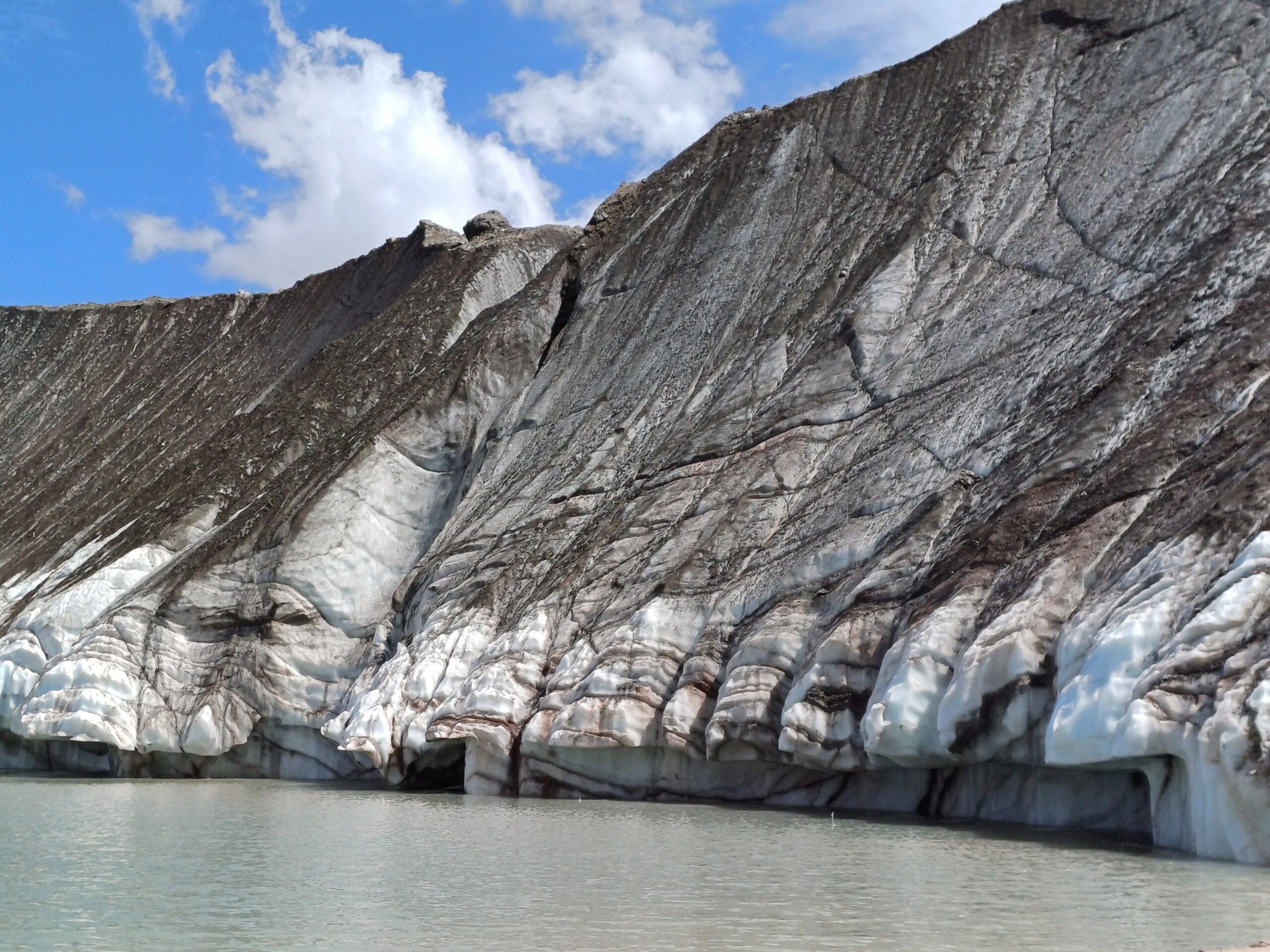
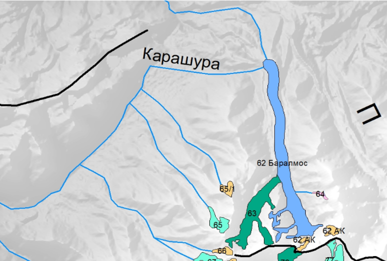
The Saidoi Nasafi (Baralmos) Glacier is a complex valley glacier located on the northern slope of the Peter the First Range (coordinates: 39°03’17.05″ N, 71°22’7.81″ E). It consists of two nearly equal ice streams and is classified as a typical Turkestan-type glacier. Its total length is 10.7 km, and surface area is 6.3 km².
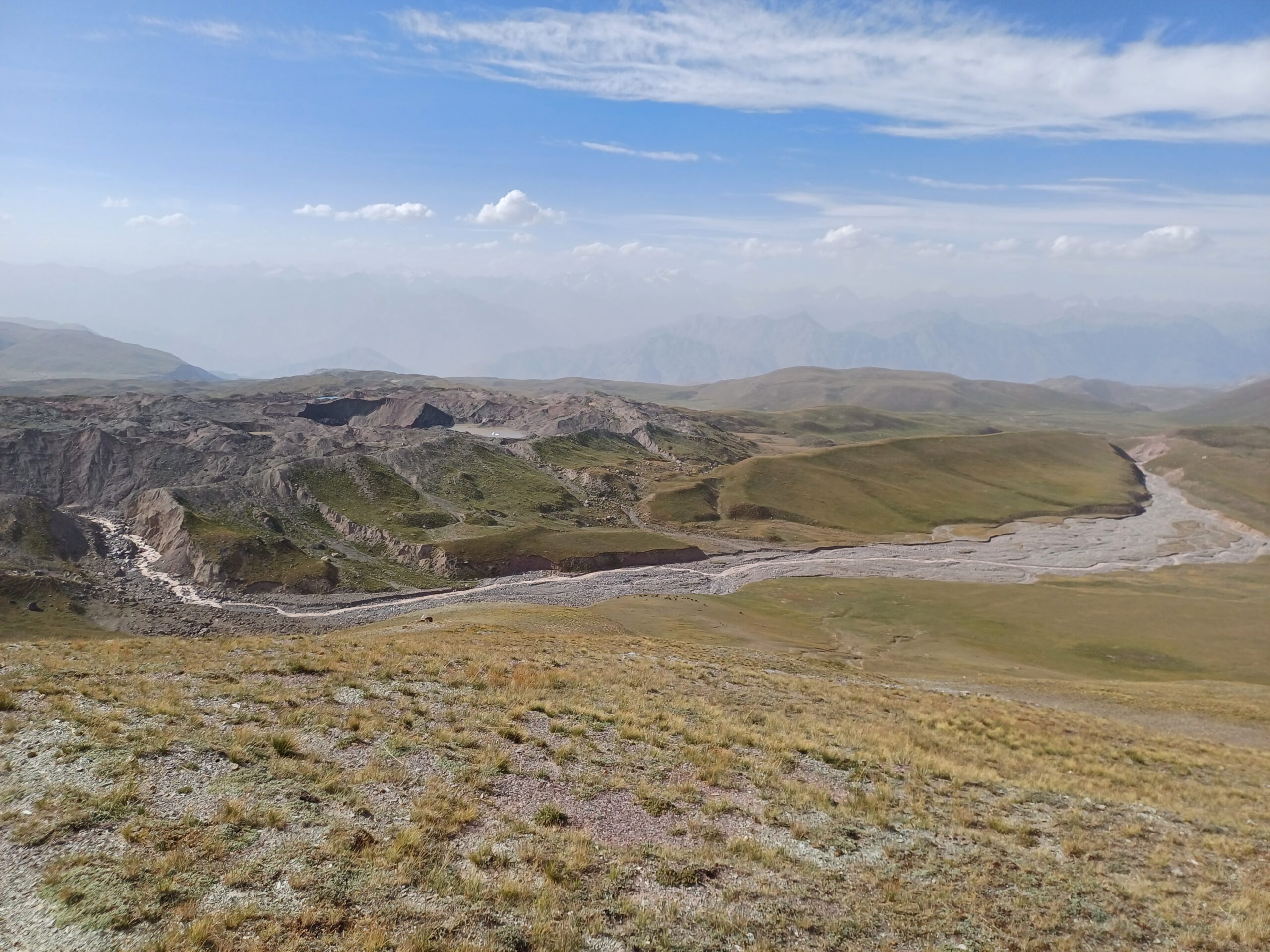
The glacier tongues are covered with moraine material, and their surface is marked by erosion channels and glacial lakes. Meltwater from the glacier feeds the headwaters of the Ragnou River (a tributary of Karashura), and partially flows into the Surkhob River basin.
The accumulation area includes avalanche-debris cones at the base of the surrounding slopes. The firn line corresponds to the lower edge of these cones, indicating complex accumulation conditions.
The region experiences high precipitation levels on the south and southwest-facing slopes — up to 2,000 mm annually or more. Most precipitation falls in winter and spring, while the summer months (July–September), which coincide with glacier ablation, are the driest. River runoff in the basin is primarily fed by glacier melt, seasonal snow, and groundwater, the latter accounting for about 30% of the annual flow.
Tajikistan faces a high level of natural hazards: around 85% of the country is prone to mudflows, and 32% is considered high-risk. The Districts of Republican Subordination (DRS), where this pilot site is located, are among the most vulnerable, with the highest recorded number of hazardous processes, including mudflows, landslides, floods, and erosion.
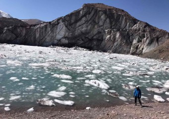
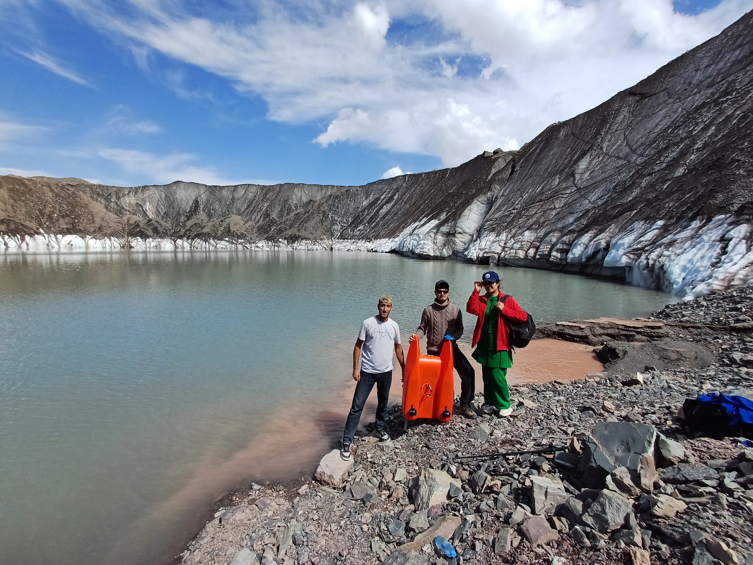
The most dangerous type of mudflow is the water-ice-debris flow, which typically occurs following the outburst of glacial lakes. This is precisely the type of event observed at the Saidoi Nasafi (Baralmos) Glacier, where several glacial lakes are located in the lower part. These lakes form under unstable conditions and pose a serious threat to downstream areas, including the international road running along the Surkhob River and nearby settlements.
According to scientific estimates, between 1990 and 2019, the global volume, surface area, and number of glacial lakes increased by 53%, and by around 20% in Central Asia. This trend continues under ongoing climate warming. In Tajikistan, more than 4,100 natural disasters were recorded between 1997 and 2018, with mudflows remaining the most frequent and deadly type of hazard. Their occurrence increases significantly during periods of heavy rainfall.
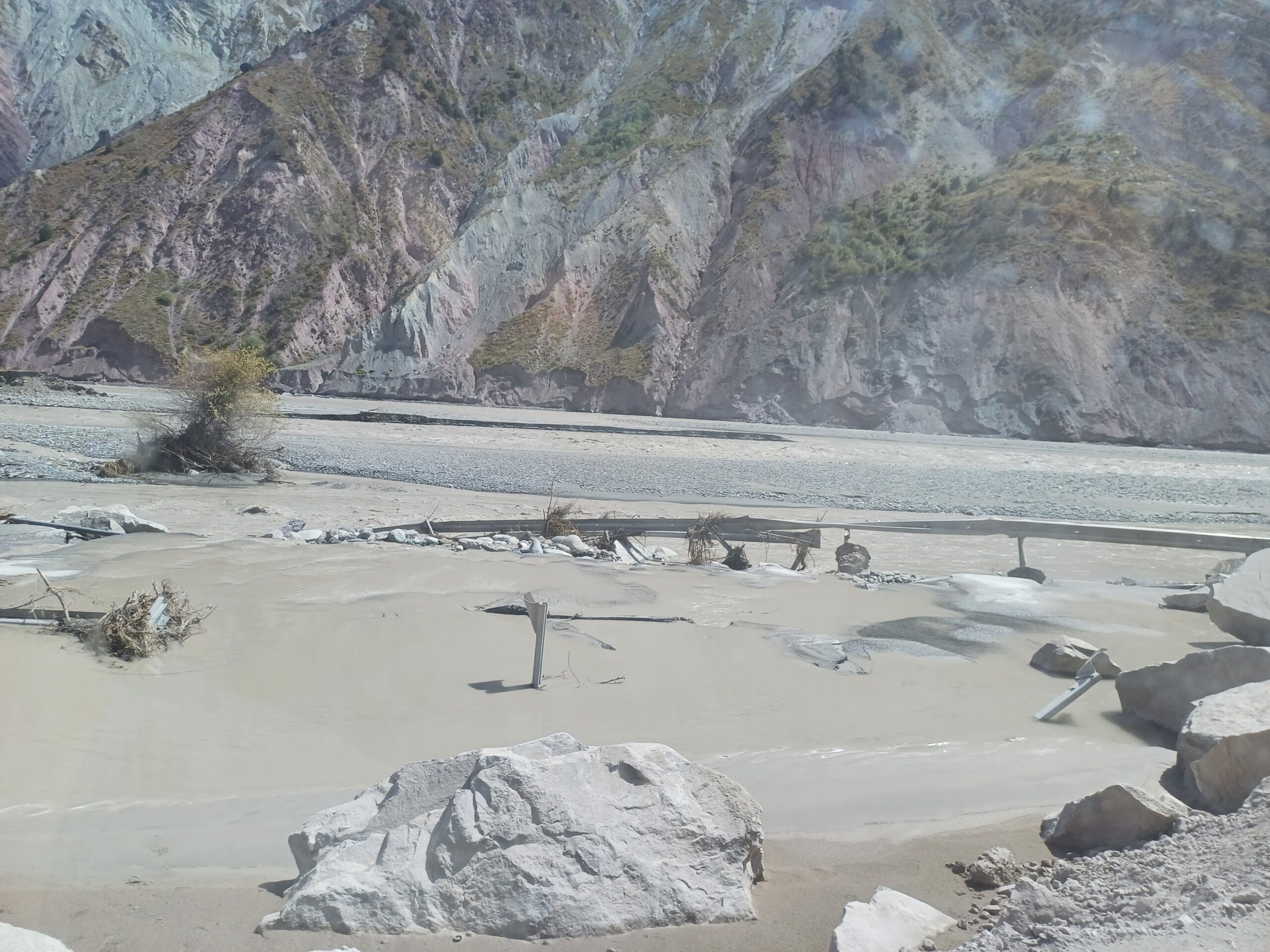
At the Saidoi Nasafi (Baralmos) Glacier, lake outburst events have become significantly more frequent since 2018. Between 2018 and 2021, five outburst floods were recorded. In 2023 alone, five additional events were officially registered. Each of these floods caused damage to transport infrastructure along the Surkhob River, including sections of the international highway. The most at-risk areas include the Dushanbe–Lakhsh and Nurabad–Sangvor roads, as well as the villages of Jailgan, Maidonterak, Duvana, Kushagba, and the Jilondi Bridge.
In addition, glacial lake outbursts from Baralmos Glacier led to two mudflow incidents in July 2021, damaging the Vahdat–Lakhsh highway. One of these events caused an estimated 20 million somoni in damages. The causes were rapid glacier melt triggered by rising air temperatures and critical lake overflow.
To reduce the risk of glacial lake outburst floods and their impacts in the Saidoi Nasafi (Baralmos) Glacier area, it is essential to maintain continuous monitoring of glacial lakes, improve forecasting capabilities using modern technologies, and expand early warning and communication systems in remote mountain areas. Public awareness and training in emergency preparedness are also crucial, as is the protection of critical infrastructure such as roads and bridges. Additional engineering measures — such as controlled lake drainage and protective constructions — play an important role in reducing vulnerability to climate-related disasters.
Downstream along the Surkhob River lie the Rogun and Nurek hydropower plants. Increasing frequency and volume of glacial lake outburst floods, along with associated debris flows, raise the risk of large inflows into these reservoirs. Such events could have significant impacts on the country’s economy, as well as on ecosystems and the environment.
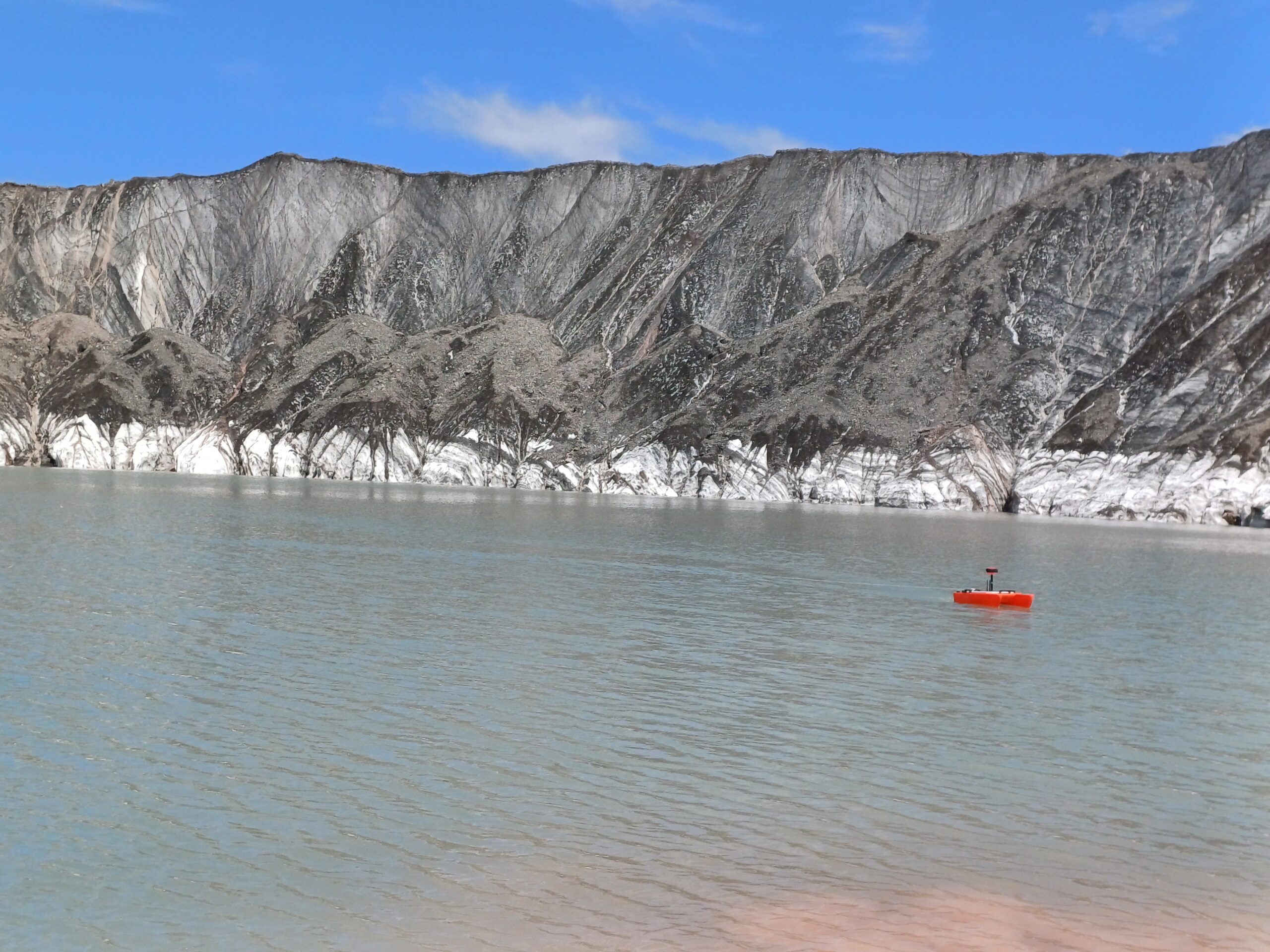
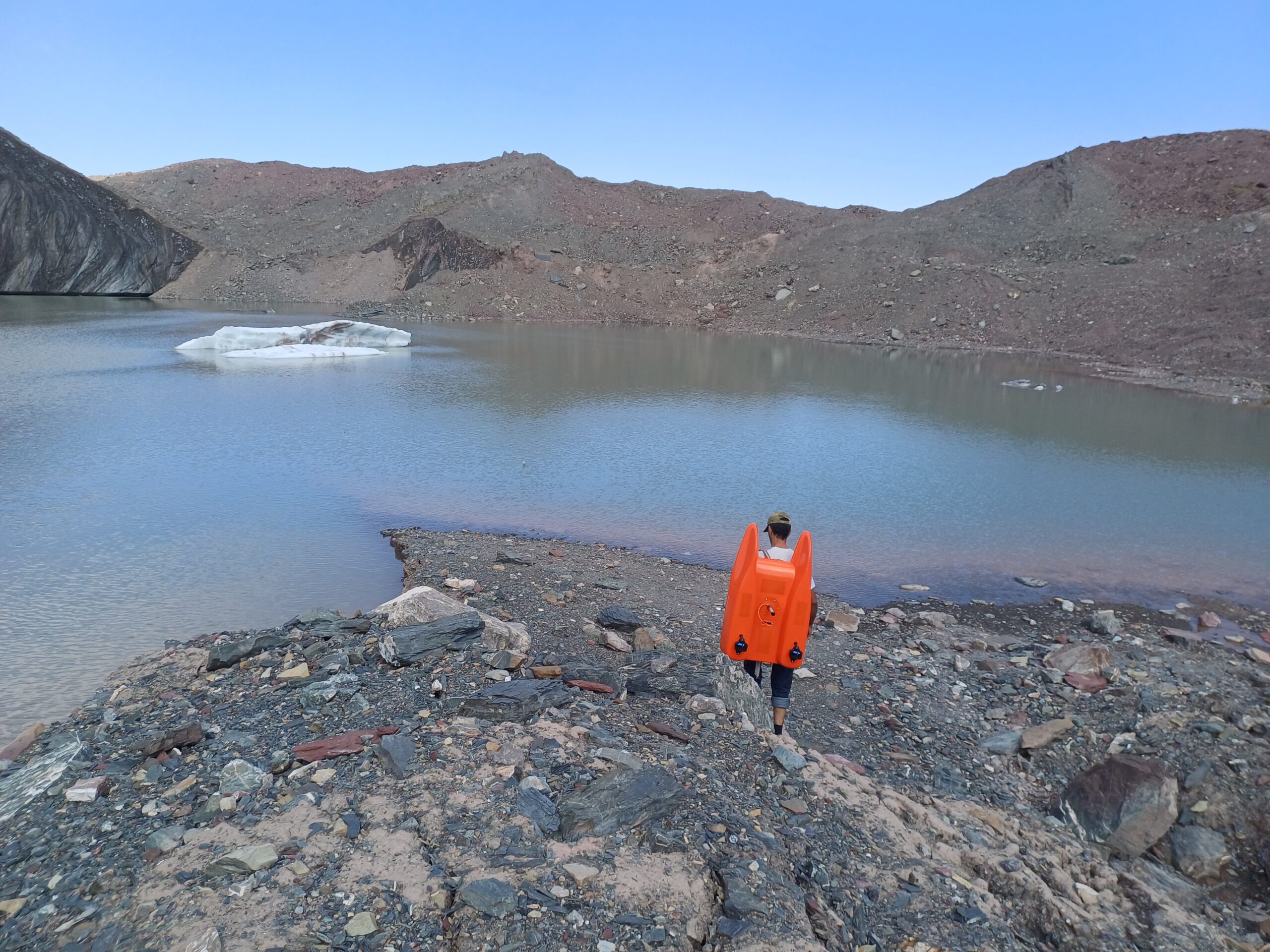
Within the framework of the GLOFCA project, a series of risk reduction measures are being implemented in the Saidoi Nasafi (Baralmos) Glacier area. Automatic sensors are being installed to monitor snow accumulation, air temperature, and precipitation, alongside radio communication and early warning systems for local authorities and communities. Regular bathymetric surveys are conducted to track the evolution and risk level of glacial lakes. Hazard modelling and assessments of high-risk areas are also underway.
The project is modernising data collection, processing, and interpretation systems, including dynamic databases, GIS platforms, and computer-based modelling of glacial lake outbursts and debris flow formation. Slope stabilisation works are being carried out in the most vulnerable areas, including the construction of terracing structures. Public awareness campaigns and training programmes are also being implemented, supported by visual and audiovisual materials. One of the project’s key interventions is the controlled drainage of the most unstable glacial lakes to prevent future outburst events.